|
|
| Day
6 6th July 2006 |
|
6th
July 2006: Day 6 Frostproof,
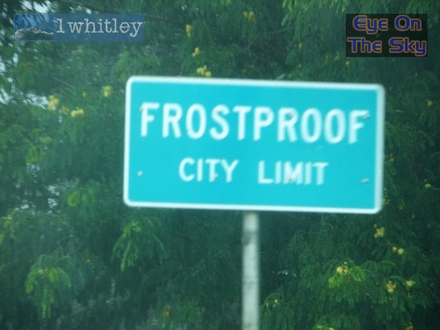
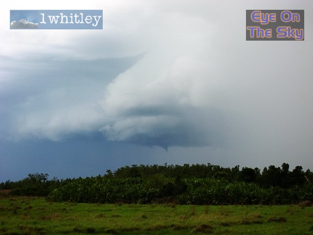
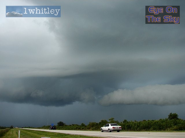
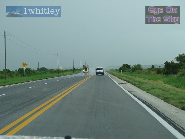
not storm-proof We headed east from Bradenton on the 64, followed by the 60. En route, we passed through the town of Frostproof. Showers had already developed along our journey, but it was as we reached Frostproof that the first thunderstorm of the day unloaded overhead. Torrents of rain turned roads into rivers, and flood water washed down the town's streets, up to a foot deep in places. We parked up to allow the downpour to subside, and as we did so, several CGs hit the deck within a few hundred metres of the Jeep. The thunder was so loud it made us jump, and shook the car quite considerably. Once the storm had passed, we moved on to the town of Lake Wales, then eastwards along Highway 60. Crossing the border into Osceola County, we found ourselves right underneath the major convergence line. The initially narrow line of menacing clouds grew at an astonishing rate, and it wasn't long before CGs were striking all around. Rain arrived without warning, as the cloud base collapsed. The torrential downpours didn't move in from any direction - instead it developed right overhead. We drove further east to get out of the rain, and were treated to a spectacular show of cloud structure. A combination of the entire rotating storm, gust fronts, numerous CGs and even a small funnel cloud made this storm one of the best we've ever seen. The flat terrain could easily have been mistaken for the Plains. We decided to leave the storm behind as time was getting on, and we headed to Melbourne on the Atlantic coast. Earlier in the day, Melbourne had received 2 inches of rain in around 20 minutes, and the wash-off debris was evident everywhere. We
found a Holiday Inn near Interstate 95, and after pigging out at a local
TGIs, we were in position for another day's chasing tomorrow. Total mileage: 226 |
| 6 |
|
|
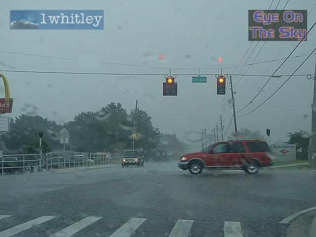 Frostproof, perhaps, but certainly not storm-proof! Torrential rain turned the roads into dancing rivers. This intersection was at the top of a hill, so remained free of flooding. . |
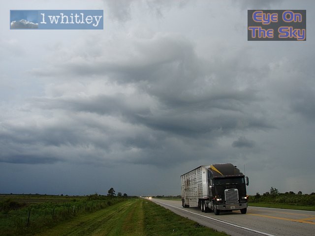
 After Frostproof, we headed north to Lake Wales, through more downpours. Here, the road in front is dry. However, in the distance a new downpour is falling, and its forward edge is marked by the sudden change to flooded roads, near the approaching truck! From dry to torrential rain and flooded roads in the space of a few inches! . |
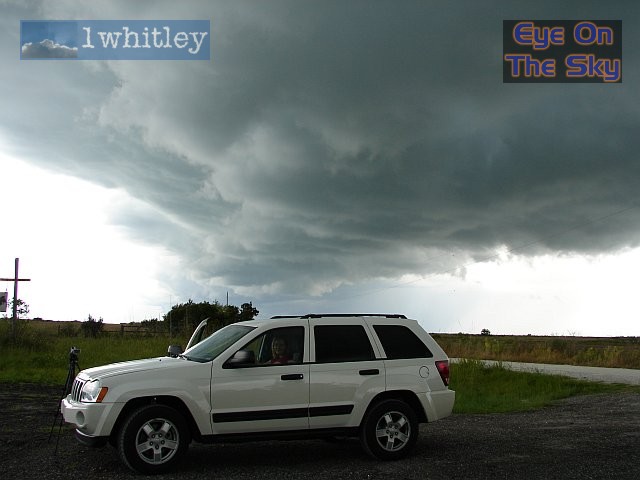 Leaving the earlier storms behind, we crossed the county border into Osceola, and found the axis of the major peninsula convergence line. This was marked by a huge and narrow area of developing updrafts, stretching from horizon to horizon. . |
|
|
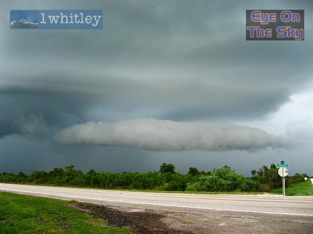 After the convergence line started unloading CGs and rain, we moved eastwards to get a view looking back. Here, a superb roll cloud developed on the leading edge of the newly forming gust-front. . |
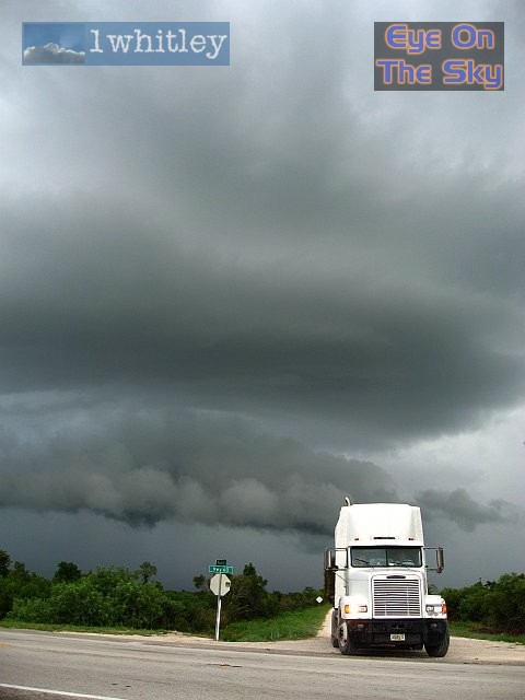 A view of the ever-developing gust-front. . |
|
|
|
|
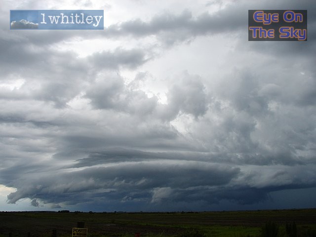 This storm was rotating like nothing we've seen before. Our timelapse captures (to be uploaded when we're back in the UK) shows this rotation well. On the left of the image, a gust-front continued to spread eastwards away from the storm. . |
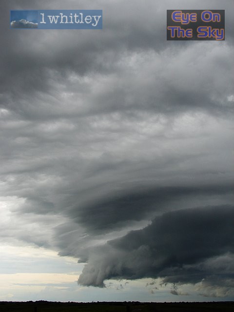 A close-up of the gust-front, seen here in a side-on view. . |
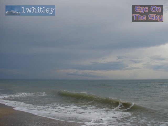 We arrived on the Atlantic coast of Florida, as the thunderstorms were slowly dying across the metropoliton area of Melbourne. Radar from GRLevel3 . |
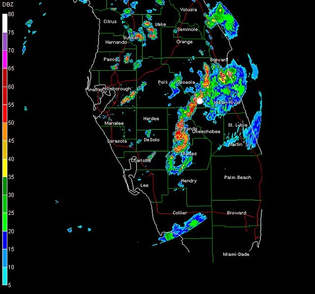 The radar image at 15:45 local time, clearly showing the convergence zone of thunderstorms. Our location is shown by the white dot. Radar from GRLevel3 . |
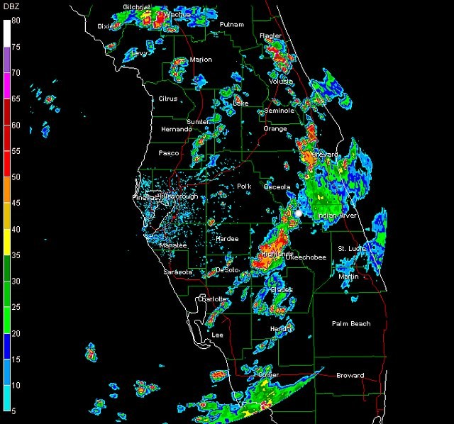 A short time later, at 16:31 local time. Radar from GRLevel3 . |
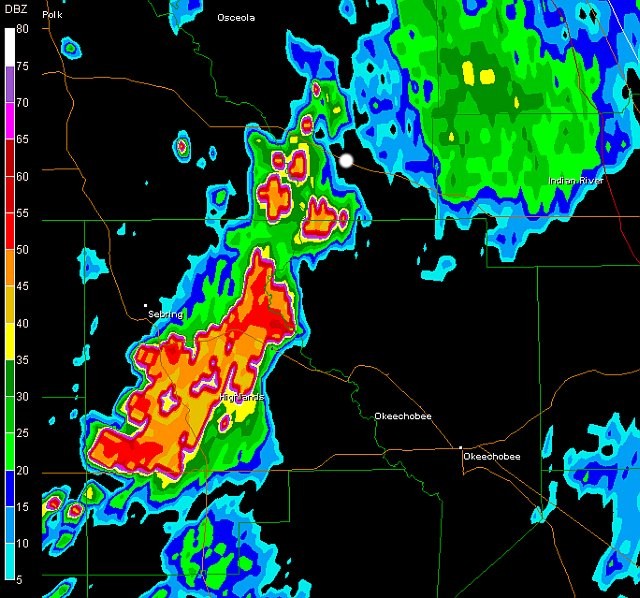 Lastly, a zoomed-in image of the previous 16:31 radar slide. Radar from GRLevel3 . |
| Day 5 :: Home :: Day 7 |