|
|
| Day 6 :: Home :: Day 8 |
|
4 July 2008 |
|
04/07 Day
7 Forking Funnels! It's the Fourth of July! For the first time in a number of days, there were no Gulf of Mexico storms overnight which meant skies were relatively clear first thing. Temperatures soared during the morning, reaching 31C by lunchtime. Today looked set to be a straight-forward south or south-easterly wind, meaning that most of our storm chasing activity would be along the west coast sea breeze front. We headed inland by early afternoon towards Zolfo Springs in Hardee County. From there, we travelled southwards to Arcadia in DeSoto County, where we bagged a Maccy D's. By this stage, small cumulus clouds were beginning to bubble up. After lunch, we headed slighty west of Arcadia into the countryside, where we parked up along a quiet road to watch the sea breeze front developing to our west. Numerous large cumulus clouds developed with one isolated thunderstorm to our south-west. This storm produced a very impressive anvil with streamed north-eastwards over our heads. It also produced a small and distant funnel cloud which lasted a couple of minutes. When it was clear that the west coast sea breeze would produce no more storms for the near future, we focussed our sights on a large outflow boundary moving southwards from earlier storms in northern Florida. Associated with this were numerous large thunderstorms which we could see from our location. We returned northwards again, then eastwards several miles from Zolfo Springs. Whilst here, the storms we were watching weakened slightly, but we spotted something on radar which would make us forget all about these storms.... We had already noted a large outflow boundary moving southwards but we hadn't spotted a smaller boundary moving north-westwards from storms in the Miami area earlier. Not only this, but the west coast sea breeze was moving slowly eastwards in the Bradenton area. All of these boundaries were closing in on one another head-on. We spent time deducing exactly where all three of these boundaries would crash and concluded that it was about 15 miles to our west. Therefore, by early evening, that's where we headed. About 10 miles west of Zolfo Springs, we parked up on a quiet road with good 360 degree views. Huge storms were firing to our south-east, north-east and west, as each seperate boundary closed in on us. We observed some amazing cloud structure as the first two boundaries collided to our east. The persistent and strong updraft on this boundary collision was corkscrewing skywards and rotating vigorously, maintaining itself for over an hour. This then created a zipper affect as the boundary collision closed westwards towards us, bringing thunderstorms closer and closer. Eventually, we found ourselves just a few miles to the east of where the two outflow boundaries, moving westwards, collided with the Gulf coast sea breeze, moving eastwards (all very complicated - the diagram makes it easier). This occurred just before sunset, and as thunderstorms erupted along this collision line, it gave us a spectacular night-time lightning show. One of the updrafts along this line was almost wedding cake-shaped and appeared to be rotating. We managed to stay completely dry until the storm started to die out, and became outflow dominant, sending rain our way. Coupled with the superb lightning, 4th of July fireworks began lighting up the sky as Floridians celebrated Independence Day. It was amazing to watch large fireworks being absolutely outclassed by Mother Nature's fireworks, some of which were rather closer than we'd have liked. Happy Independence Day America! Total mileage: 186 |
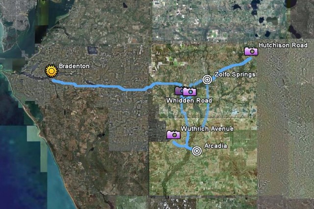 GPS route: Bradenton-Arcadia-Zolfo Springs. Map from Google Earth. . |
 This chap, sat in a car in Arcadia, didn't stop staring at us. IQ levels seemed limited. . |
 I think this beast ate the little rat-dog shortly after we left. . |
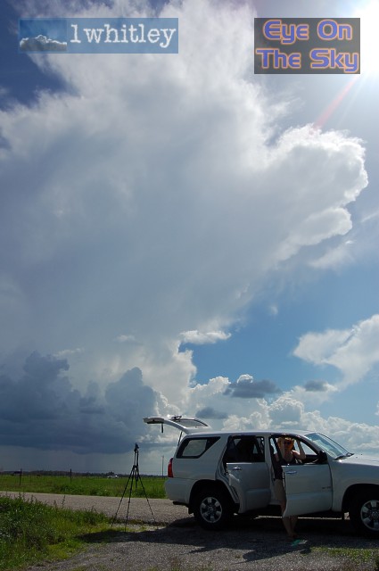
 Parked up west of Arcadia, and discrete cumulus began to bubble up as temperatures hit the mid 30s. . |
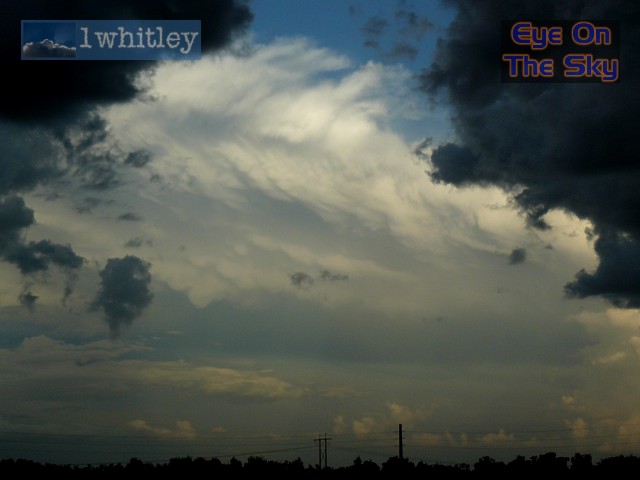
 Looking south-west, the Gulf Coast sea breeze spawned an isolated thunderstorm. . |
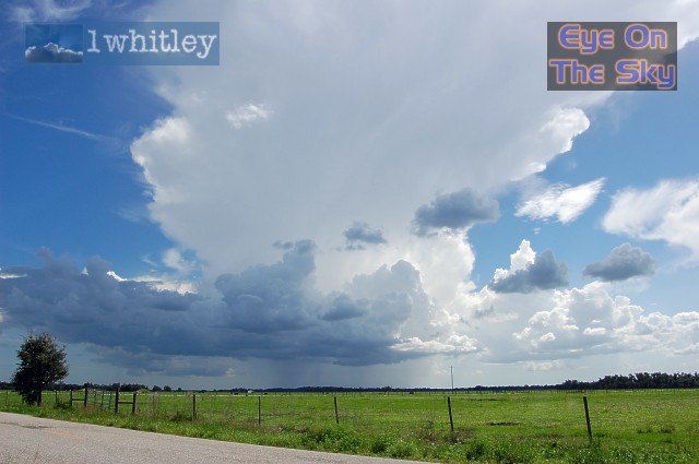 Whilst the storm was small, it sent out an amazing, sprawling anvil which passed over our heads. . |
 A radar grab of the storm (bottom left) and the satellite image of the anvil spreading north-eastwards in our general direction (our location depicted by circle car marker). Radar from GRLevel3. . |
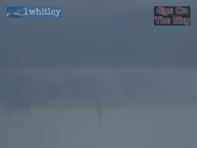 This small funnel cloud appeared beneath the storm for a few minutes. . |
|
|
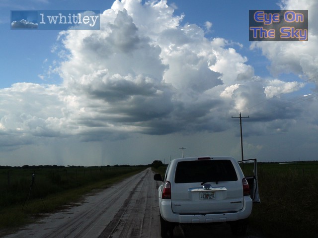
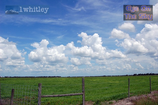
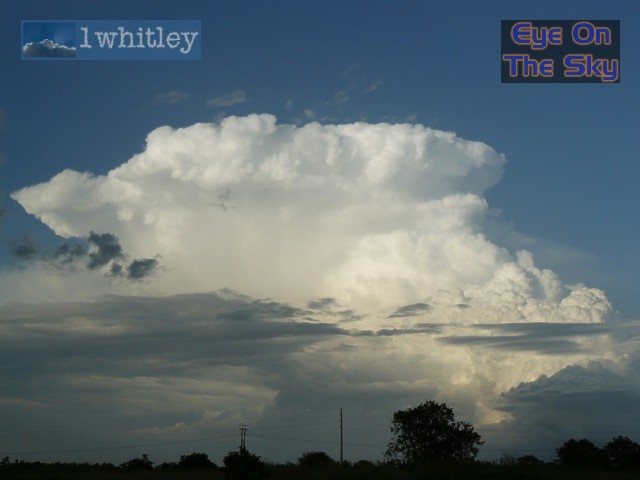
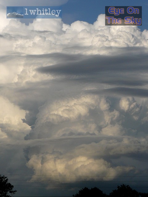
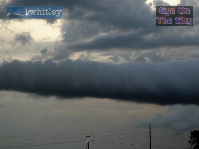
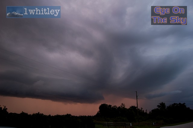
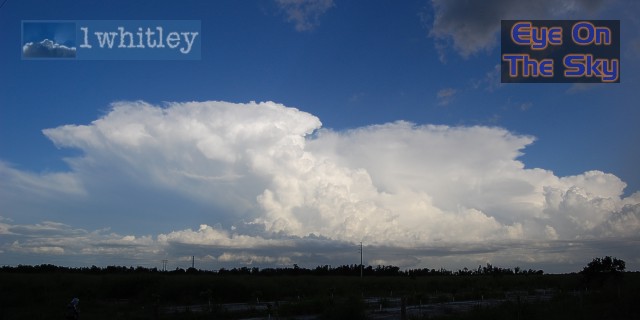 The view from our final location, west of Zolfo Springs. This amazing storm had developed on the boundary moving north-westwards from the Okeechobee area. . |
 Whilst looking west, the Gulf Coast sea breeze was developing more showers. . |
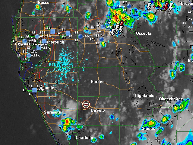
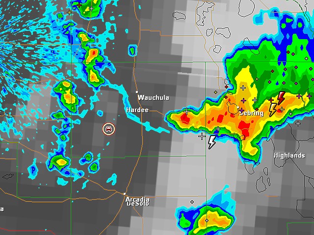
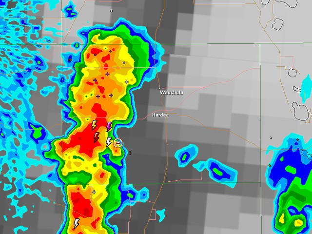
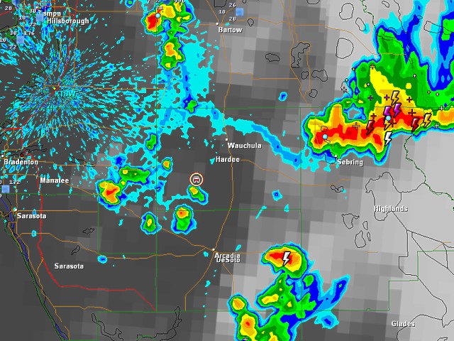 This radar grab shows our location (car marker) relative to all three boundaries and their associated storms. Radar from GRLevel3. . |
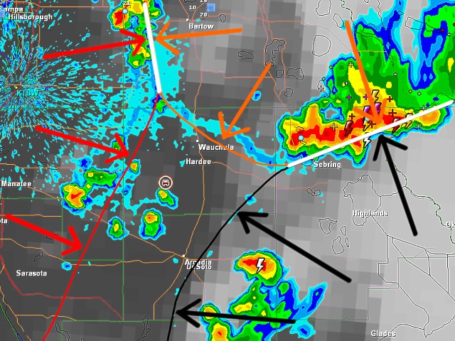 We've annotated the radar image above to make things clearer. The red line (left) indicates the eastward-moving Gulf Coast sea breeze boundary. The orange line (top right) indicates the southwestward-moving outflow boundary from earlier storms in north Florida. The black line (bottom right) indicates the northwestward moving outflow boundary from earlier storms in south-east Florida. The two white lines indicate where boundary collisions have already occured, and storms have fired on these collisions. . |
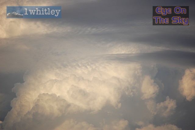
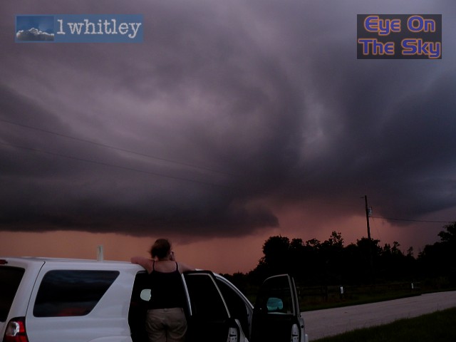
 This storm was on the collision of the two outflow boundaries to our east. The new updraft development on the right of this storm would become very strong. . |
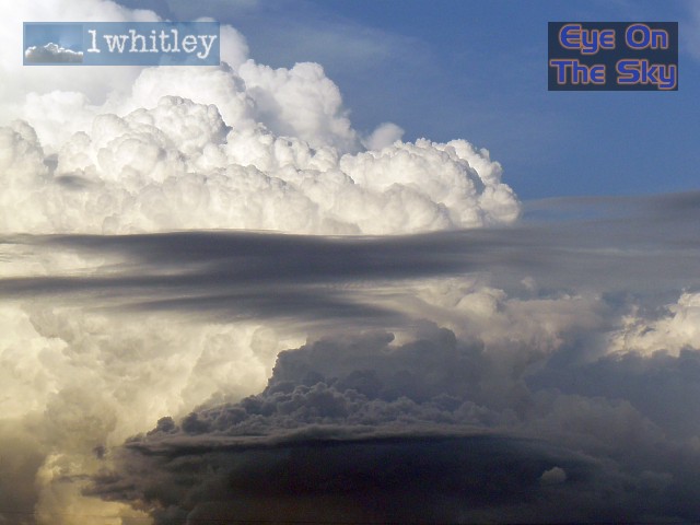 Amazing cloud structures developed to our east as the newly developing boundary storm fired in our direction. As well as the large updraft, mid-level convection was taking place on storm outflow. . |
 Clouds at all levels in the atmosphere. Outflow skirts at low levels, mid-level convecting gust fronts at mid levels, layer cloud at mid-levels, and the chimney of the main updraft at all levels. . |
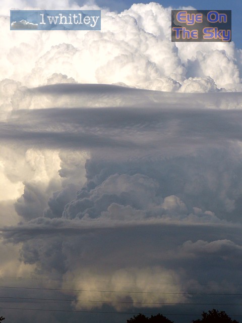
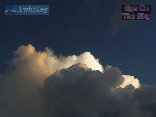
 A close-up of the main updraft tower, hiding behind mid-level layer cloud. . |
 This strong updraft was rotating vigorously and cumulus was being corkscrewed anticlockwise around the tower, almost in a barber-pole manner. . |
 Meanwhile, the storm to our south-east was weakening, leaving a display of anvil mammatus. . |
 A radar grab a short while later. The south-east boundary had now reached our location (albeit diffuse on radar) and produced a fresh wind from the south-east. The collision of this boundary with the north-east boundary was allowing the large storm to our east to continue building new updrafts towards us. Storms to our north and west were now firing as all both boundaries met the west coast sea breeze front. . |
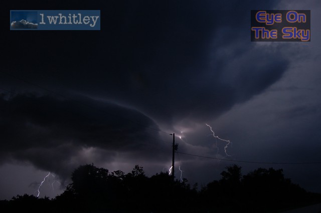
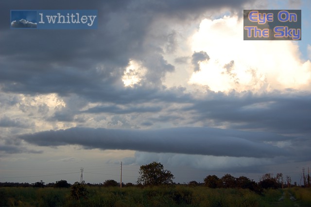 A nice roll cloud developed on the low-level gust front from the storm to our east. . |
 A close-up of the roll cloud which was spinning about its horizontal axis. . |
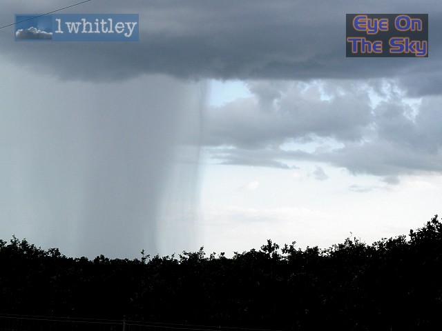
 The storms to our west were now getting their act together. Here, a wet microburst hammers groundwards. . |
 The sun was now setting to our west, lighting up the undersides of the new storms forming along the Gulf Coast sea breeze boundary. . |
 Checking out the sunlit rain shafts. . |
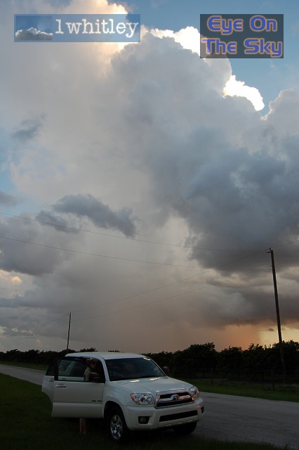
 The cloud in the centre of this shot looked like a face peering downwards towards the ground. . |
 A newly developing updraft began to tighten up and the whole thing started to rotate. Even in this static image, the striations allude to its rotating motion. . |
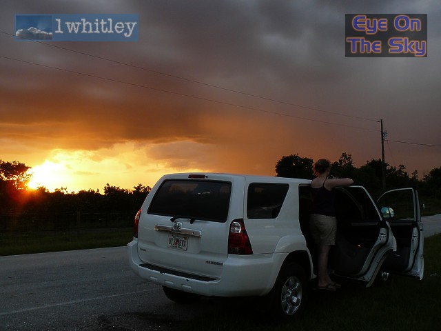
 The cloud was still lit up well in the fading light. . |
 The tops of the cloud were now reflecting the last of the sunshine, coloured depending on height. . |
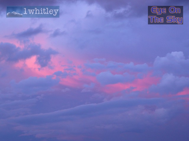 The storms to our east were lit up pink by the setting sun, whilst the lower cloud was already in the Earth's shadow. . |
 A radar grab after dark, showing our location (car marker) in relation to the storms firing along the final collision between all three boundaries. Radar from GRLevel3. . |
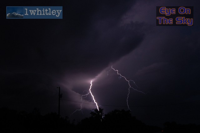 And now began the light show, though sadly with no way of escaping the electricity cables. A nice CG! . |
 The smooth updraft lights up nicely here as lightning flickers inside. . |
 A powerful CG (cloud-to-ground lightning strike) nails a small, unsuspecting cloud half way down. . |
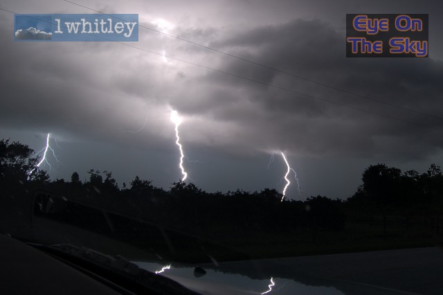 The Triple Whopper! . |
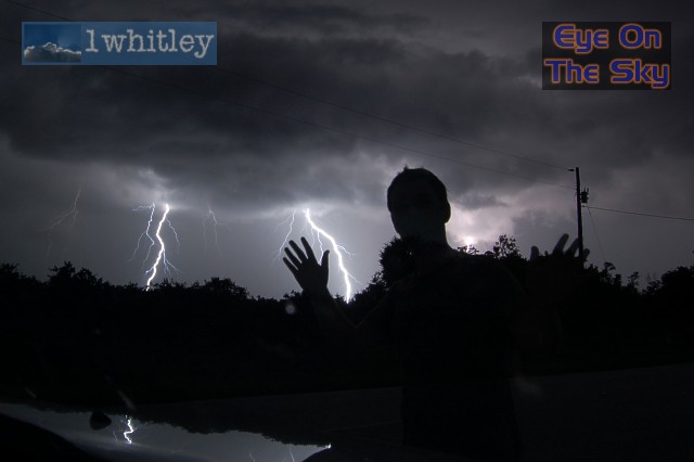 After resetting the video camera which was outside the car, Bren decides to ruin Laura's long exposure shot by posing briefly in front of the car. It turned out to be a money shot! It also sent Bren scurrying for the car! . |
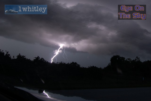
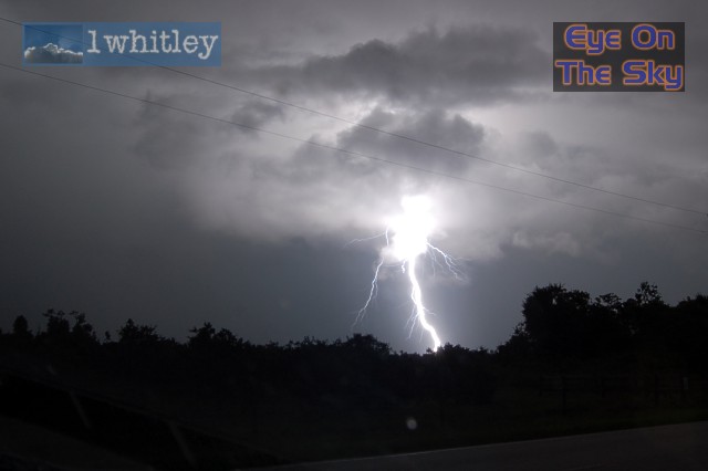 And lastly, a huge positive strike lights up the countryside. . |
| Day 6 :: Home :: Day 8 |