|
|
| Day 8 :: Home :: Day 10 |
|
6 July 2008 |
|
06/07 Day
9 The Tampa Bay Muncher! Another hot and sunny morning greeted us with blue skies overhead. Out to the west, towering thunderstorms were already looming on the horizon, sitting around 30 miles offshore over the Gulf of Mexico. Once the morning swim was out of the way, we started truckin', heading inland to Zolfo Springs, then southwards to Arcadia. Large and very active thunderstorms were developing on the western side of Lake Okeechobee, so we decided to head even further south into northern Charlotte and Glade counties. However, by the time we arrived the storms were dissipating. On checking the radar, it became obvious that the east coast sea breeze was trampling westwards across the state at a rate of knots, and was firing widespread storms to our north across Highlands and Osceola counties. We also noted that the west coast sea breeze was slowly moving eastwards and inland. Anticipating a major boundary clash, we headed back northwards towards home. On the way, we passed through a developing line of storms just behind the east coast boundary, which left flooding in Arcadia as torrential rain pounded the town. By now it was early evening and the developing line of storms had formed a squall line feature which was accelerating westwards towards the Gulf Coast. We'd seen this before back in 2006 and knew that it would develop very nasty thunderstorms as it met the west coast sea breeze which was still close to the Gulf coast. We headed to the Sunshine Skyway, after a brief stop to observe the approaching gust front. With great views to the south and the north, we were struggling to decide which was best as we stopped in the picnic area to the south of the bridge. However, a very large, very evil-looking thunderstorm began to take shape over northern Tampa Bay, heading towards the city of Tampa. In order to get a better look, we headed across the Skyway to the northern picnic area. The thunderstorm became severe as it pounded Tampa and northern parts of Tampa Bay, including Pinellas County. Reports of golf ball hail and wind gusts to 70mph were reported. We kept ourselves just out of the storm, thankfully, and as a result enjoyed spectacular views of the most striking gust front/shelf cloud we'd ever seen. This was heading slowly southwards towards our location, lit from within by frequent cloud-to-water lightning. Winds were relentlessly blowing at around 30-40mph in out location, first from the south, then from the north as the gust front approached. After an hour or so, the storm slowly weakened, and we decided to head back to base to enjoy evening dinner. Whilst we were out chasing, Bradenton picked up a small storm, which deposited 9.1mm in about an hour in our rain gauge. As darkness fell, lightning was still lighting up the western sky, as a few thunderstorms continued to rumble away about 40 miles west of the Gulf Coast. Total mileage: 255 |
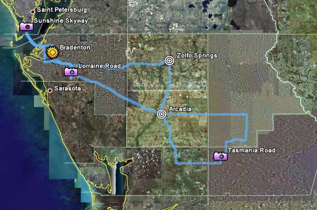 GPS route: Bradenton-Zolfo-Arcadia-Skyway Map from Google Earth. . |
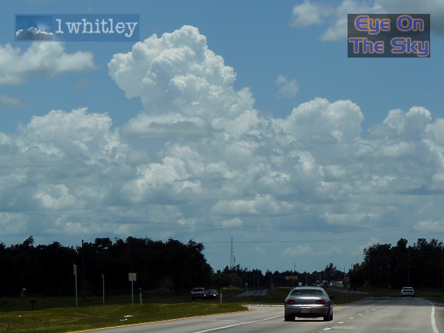
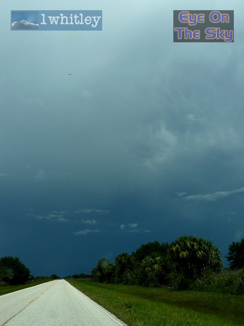
 By mid-morning, thunderstorms were already developing in the distance, just off the Gulf Coast. . |
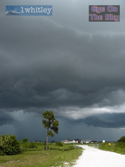
 Heading inland south of Zolfo Springs, convection began to grow stronger by early afternoon. . |
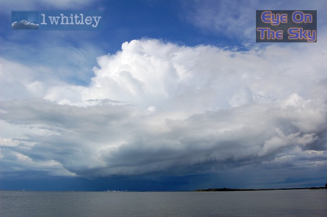
 Huge, mature thunderstorms loomed to our south and east, affecting counties surrounding Lake Okeechobee. . |
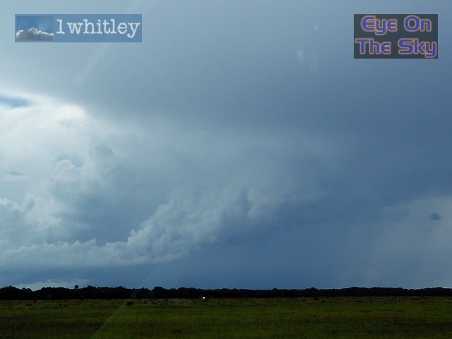 This area of developing towering cumulus was being ripped inwards and upwards towards the Okeechobee thunderstorms. . |
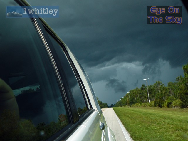
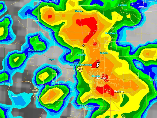 Heading back north-westwards through Arcadia, we encountered torrential rain and occasional lightning. Radar from GRLevel3. . |
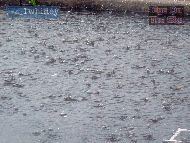 Wet. . |
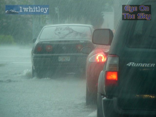 Cars struggled through the water-filled streets as torrential rain continued to fall. . |
|
|
 As we neared Bradenton by early evening, we were able to park up briefly and watch the impressive gust front/outflow boundary/Atlantic coast sea breeze front combination roar in from the east. . |
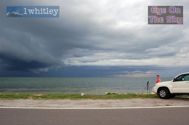
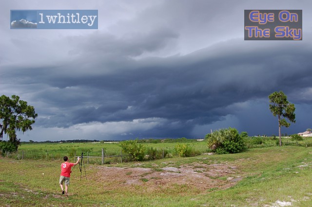 Bren rushes to set up the video camera as the gust front approaches, with only his tripod proving more keen to get there before him! . |
 The downdraft of rain and small hail was fast-approaching, so it was time to move on. . |
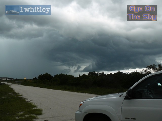
 We stopped at the south end of the Sunshine Skyway, keeping a close eye on a new storm forming in the north-eastern corner of Tampa Bay. . |
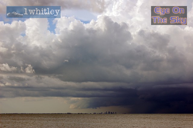 The storm grew very strong very quickly. The high-rise office blocks of Tampa were literally dwarfed by a huge gust front which roared overhead from the new storm. . |
 A close-up of the impending doom for downtown Tampa. . |
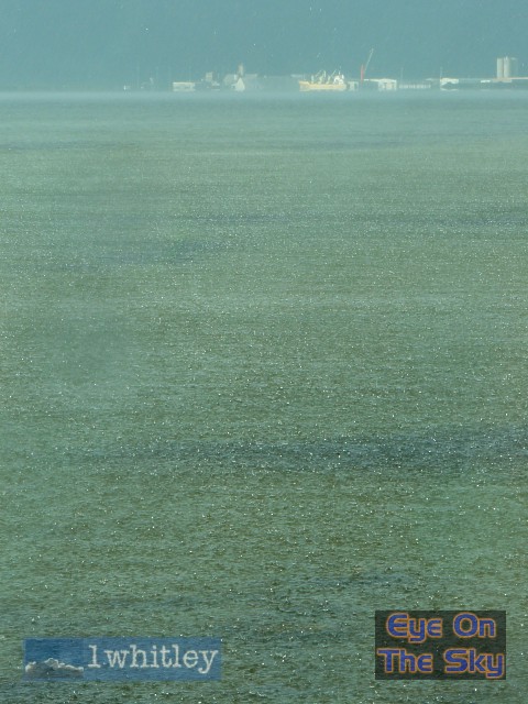
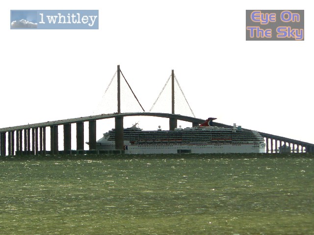 Meanwhile, this large ship decided to flee Tampa Bay, scraping beneath the Sunshine Skyway. . |
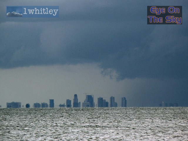
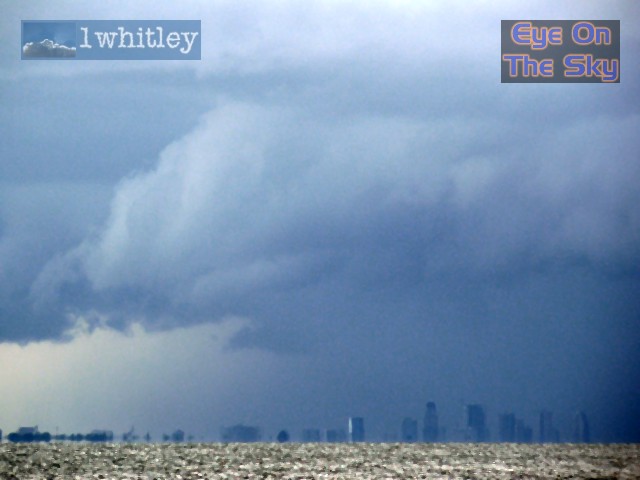 The last we saw of the distant skyscrapers before the curtain of rain, hail and lightning set in. . |
 A new shower developed overhead and quickly became heavy. Unable to get out of the car, we decided to head northwards.... . |
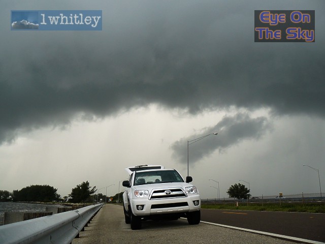
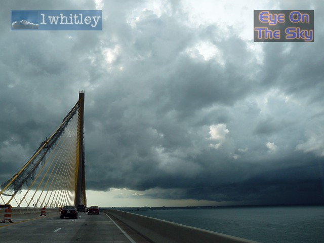 ....crossing the Sunshine Skyway. The severe thunderstorm was now sending out a large gust front in our direction. . |
 A radar grab of the severe warned thunderstorm. Hail to golf ball size was measured. Note the mean wind speed observation of 30 knots. . |
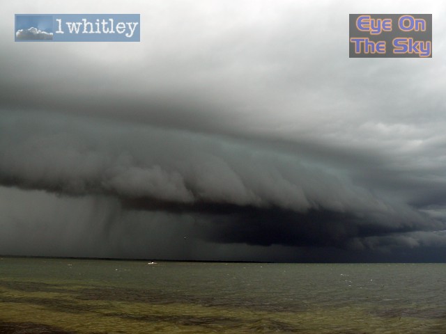
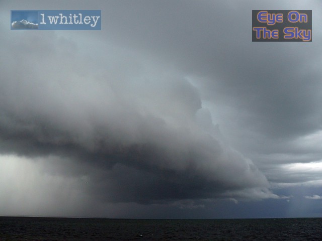
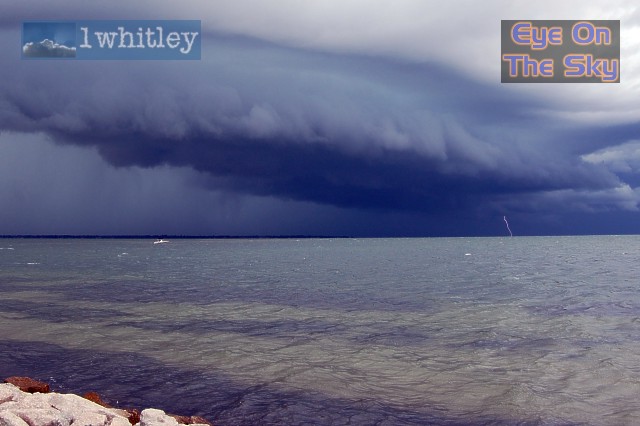 A lovely shelf cloud was moving slowly southwards across the Tampa Bay waters towards us. CGs were striking the water with impressive frequency. . |
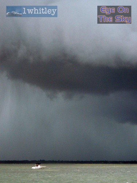 Tampa Bay quickly progressed from calm to choppy as the storm approached, with wave heights of 2-3 feet in a matter of minutes. This boat seemed to ignore all warnings as the shelf cloud approached. . |
 Meteorological perfection. . |
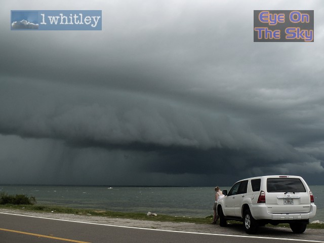 Anticipating some very strong winds as the shelf cloud approached, we parked nose-on to the wind. . |
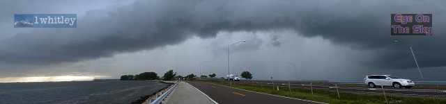
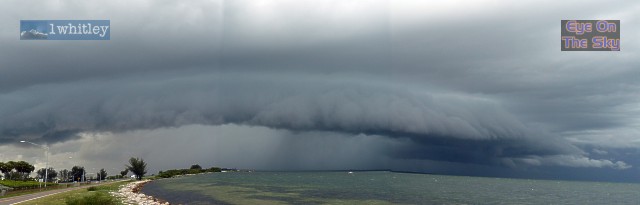 A panoramic landscape image of the shelf cloud, viewed from west, through north, to east. . |
 Preparing to take it on! . |
 The shelf started to show signs of losing some of its strength and began to look rather more ragged. . |
 Another panoramic shot a short time later. . |
 With the torrential rain within a mile of our location, and the storm weakening, it was time to return home. . |
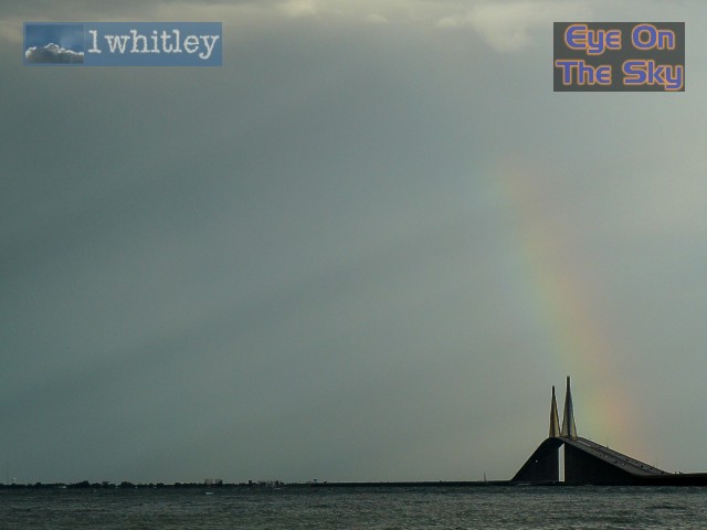 On the way home, a lovely rainbow graced the Sunshine Skyway, together with sunshine "spokes". . |
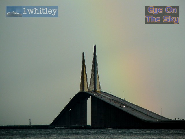 Rainbow Skyway. . |
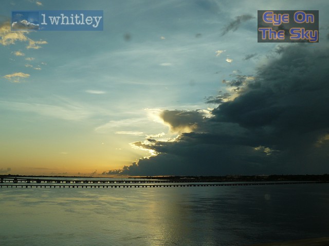 One final shot of the dissipating thunderstorm over the River Manatee outlet. . |
| Day 8 :: Home :: Day 10 |