|
|
| Day
10 10th July 2006 |
|
10th
July 2006: Day 10 Daytime
darkness on Sunshine Skyway. The day worked like clockwork! A light easterly flow commenced across the Florida Peninsula, and as this met the developing westerly sea-breeze by midday, a line of thunderstorms popped up over the Bradenton metropoliton area. These dumped a huge amount of rain in a very short period of time, causing some major road flooding. This all happened just 2 miles west of our base villa, so getting into the heart of these storms was easy. The second part of the day saw the initial activity die out, allowing the westerly sea-breeze to push further inland, against the ambient easterly flow. Showers and isolated thunderstorms developed in central areas of the peninsula during the early afternoon, and were steered eastwards. We estimated that a huge squall-line would erupt somewhere just east of the Interstate-75 corridor by early evening, and we weren't disappointed! A combination of three factors led to an explosion in thunderstorm activity. Firstly, the sea-breeze from the western side of the peninsula carried on moving eastwards. This was not only pushing against the ambient easterly flow, but also met the sea-breeze heading in from the Atlantic east coast too. Added into the equation were isolated thunderstorms already developing in the area soon to see massive convergence. And massive it was! A huge squall line erupted, spanning a few hundred miles north to south. This moved westwards at around 10mph, towards the Tampa Bay/Bradenton area. We were well-placed to move north-south along the forward edge of this line, getting some seriously nice cloud structures. However, we ran out of land as the squall line squeezed us against the west coast, and then we allowed the line to rumble over us. Rain was so heavy it resulted in zero visibility. Lightning nailed the fields and water around us, some so close we saw the smoke rising off the ground where the bolt had struck. We moved off to the Sunshine Skyway over Tampa Bay to watch the storms rumble their way westwards into the Gulf of Mexico. A nice night-time lightning show continued until around 10pm, when the storms finally dissipated. For sheer excitement and intensity, these Florida thunderstorms are the best we've seen yet. Day turned to night, monsoon-like rain was unrelenting, and CGs were louder and closer than we've ever experienced before. A special thunderstorm statement was issued by the National Weather Service whilst we were chasing, although sadly, our ability to download radar on the road was disrupted. 297 SPECIAL
WEATHER STATEMENT ...A LINE OF STRONG THUNDERSTORMS WILL AFFECT HILLSBOROUGH AND MANATEE COUNTIES... A LINE OF THUNDERSTORMS MOVING WEST AT 10 MPH...WILL AFFECT TEMPLE TERRACE...BRANDON...LUTZ...TAMPA...RIVERVIEW AND SUN CITY...UNTIL 715 PM EDT. GUSTY WINDS 40 TO 50 MPH MAY CAUSE LOOSE OBJECTS TO BLOW AROUND. MINOR DAMAGE TO TREE LIMBS AND WIRES IS POSSIBLE. FREQUENT CLOUD TO GROUND LIGHTNING IS EXPECTED. IF CAUGHT OUTSIDE...CROUCH DOWN IN A LOW SPOT...AWAY FROM TALL OBJECTS. THESE STORMS WILL PRODUCE PEA SIZE HAIL. TORRENTIAL RAINS WILL REDUCE VISIBILITY TO NEAR ZERO AT TIMES. MOTORISTS MAY WANT TO DELAY TRAVEL. Total mileage: 121 |
| 6 |
|
|
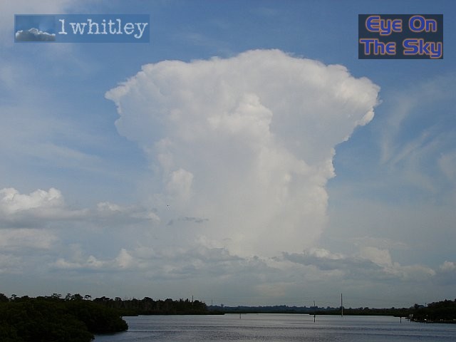
 The early-afternoon westerly sea-breeze was initially pinned to the coast by the ambient easterly flow. This allowed this line of thunderstorms to develop over Bradenton. Note the abrupt downdraft of rain to the left of the image. . |
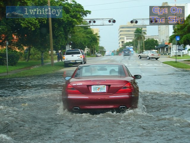
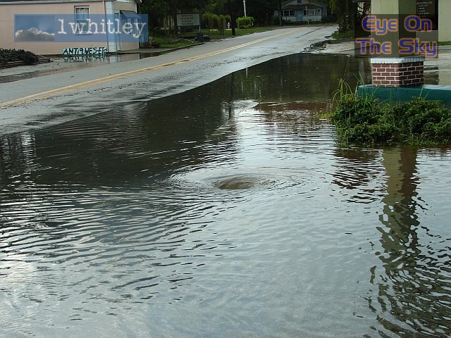 We took a quick drive westwards into Bradenton to see what was going down. One notable thing going down was acres of ponded water, down the drain! In this case, a nice whirlpool developed. Elsewhere, heavy metal drain covers had burst onto the road and floated away. . |
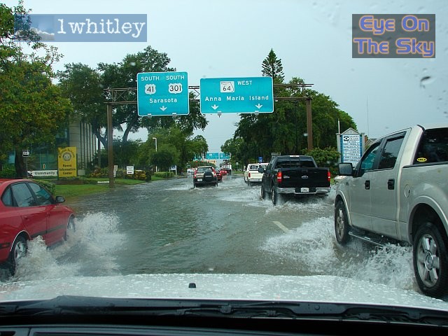 Steady as she goes! Cars and SUVs tread carefully through the flooded roads of Bradenton. Some of the floods went on for ages, up to a foot or more deep in places! . |
|
|
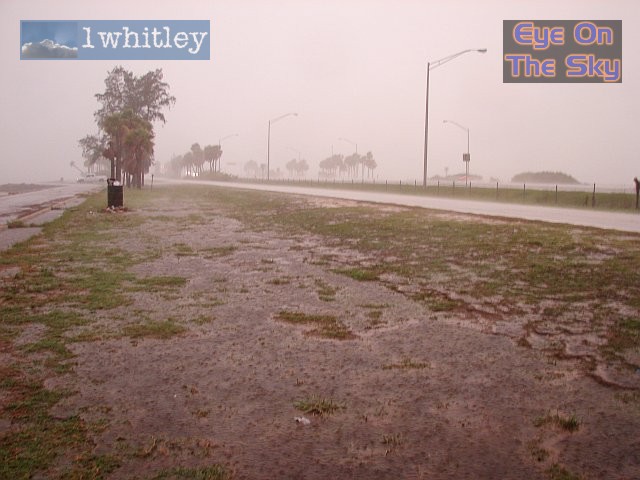
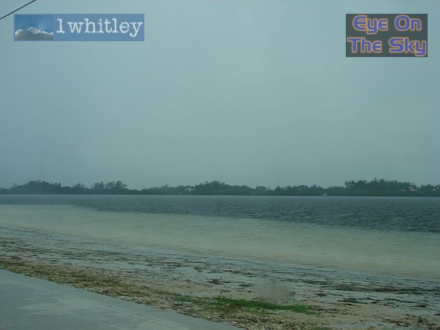 A good example of how heavy the rain was. Here, the rainwater had run off the road and across the beach, scraping the sand away and washing it into the lagoon. . |
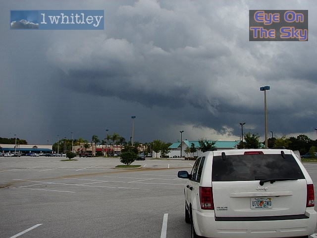
 Heading back eastwards and inland, once the initial sea-breeze activity had died away. However, further inland, more 'pop-corn' convection was already kicking off. . |
 Towering above the surrounding countryside, more individual thunderstorms started kicking off by mid-afternoon. The river Braden is in the foreground. . |
 Now into the late-afternoon period, and we'd headed further eastwards inland, to intercept the newly developing squall-line. This lovely curved updraft became well-separated from the rapidly widening downdraft of rain. . |
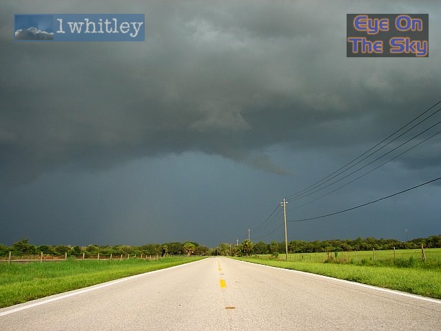 Gust-front galore! The wide, sunny roads of Florida led into the storm's heart. CGs were already slamming down in the distance, and the thunder was growing louder. . |
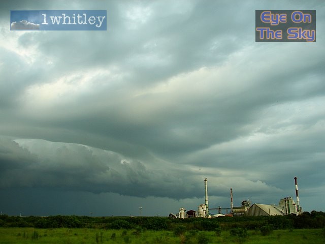 The updrafts became very elongated and striated north-south along the developing squall-line. It wasn't hard to decide where the rain had reached, given the perfectly shaped shelf cloud! . |
 Another view looking northwards along the axis of the squall line. Once again, the striations on the uprdrafts were spectacular! . |
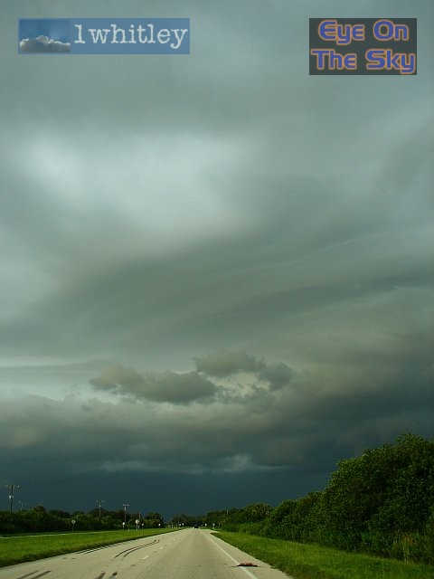
 Pinned to the coast with nowhere to go, we could only watch as the shelf cloud rumbled westwards over us, opening the floodgates for CG after CG (Cloud-to-Ground lightning). |
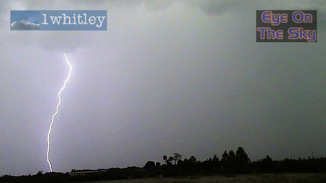
 A wake-up call! This CG slammed down within 50 metres of the car, just beyond the trees. The thunder was without doubt the loudest noise we've both heard, and it shook the car violently! |
 This is the return stroke from the close CG pictured above. Moments after the lightning bolt, a puff of grey smoke rose into the air from just behind the trees. |
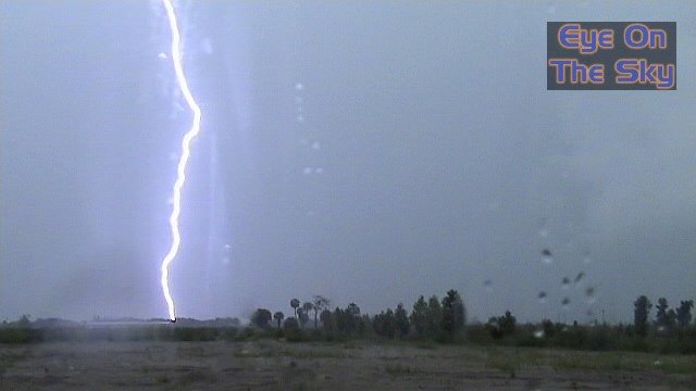 Another fairly close CG, just a few hundred metres away. By this time, we were nearing the back edge of the squall line, and decided to head across the water westwards onto the Sunshine Skyway. |
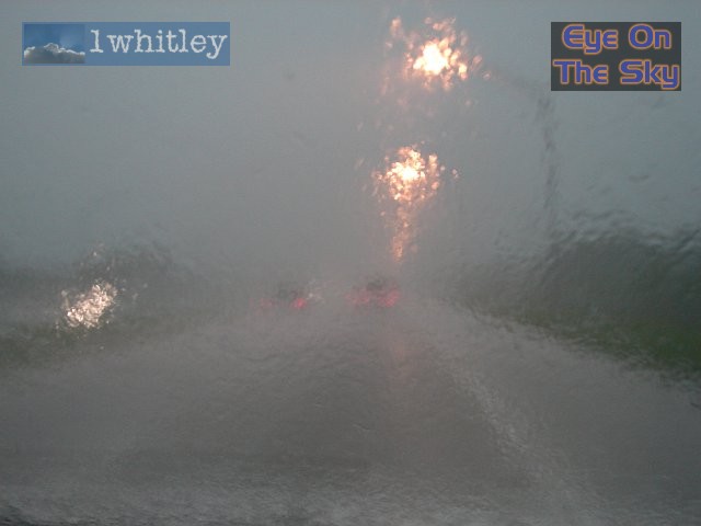 On the I-275 towards the Skyway, visibility was near zero. This was travelling at 20mph on the interstate, with wipers going as fast as they could. Still, we couldn't see a thing, and the road surface was under a moving sheet of 2-3 inches of water. |
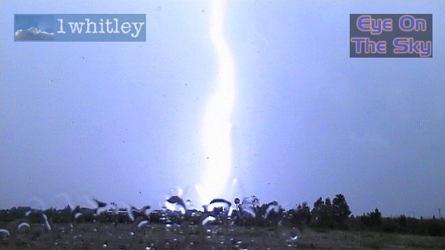
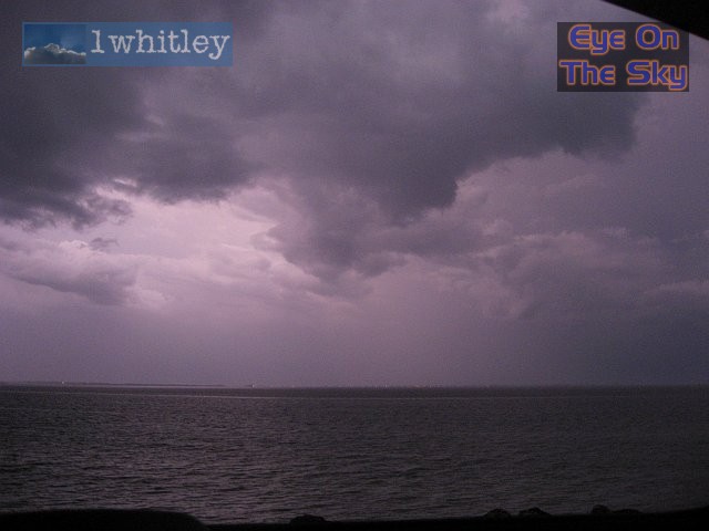
 At the Skyway, we popped the back hatch up on the Jeep, sat in the boot and pointed our cameras into the dark sky. The sun should still have been up at this point! As the sun set, the lights on the Skyway came on, but kept getting knocked out by occasional CGs. . |
 This photo doesn't do the scene justice. Blinding sheets of rain were set pink by the setting sun, which was just about poking through the upper reaches of the storm anvil. . |
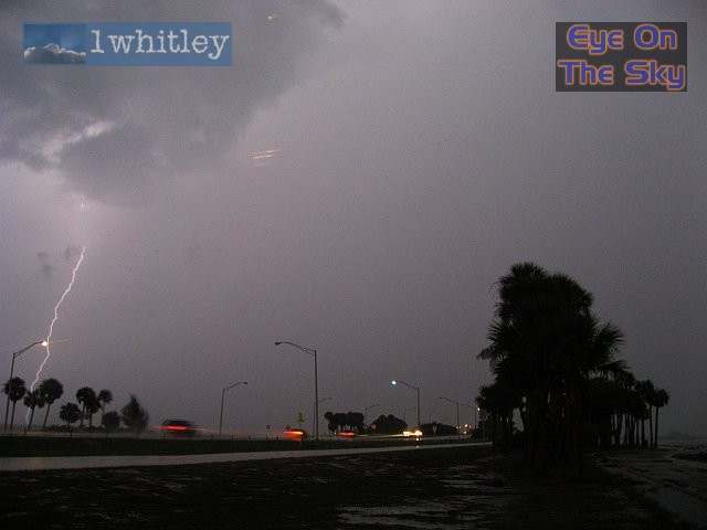
 This was shortly after 9pm, and the view should have been pitch-black. However, CGs seared down onto the Bradenton Peninsula across the water, lighting up the scene. |
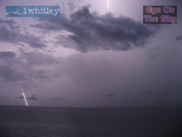
 More inter-cloud lightning, illuminating an otherwise pitch-black scene. |
| Day 9 :: Home :: Day 11 |