|
|
| Day
12 12th July 2006 |
|
12th
July 2006: Day 12 Waterspouts
& miracle escapes! With a strong easterly flow persisting, and abundant tropical moisture, we decided that the ultimate firework display would happen right along the west-coast beaches. The easterly wind was strong, so strong that we feared it may surpress the westerly sea-breeze altogether, allowing convection to explode over the Gulf instead of over the land. We picked our target area based on this forecast, and also based on where maximum solar input would be during the first half of the afternoon. This would be the coastal area of north Pinellas and south Pasco, to the north of St. Petersburg. The morning started benign enough, with blustery east winds and fast-moving cumulus. We travelled to the Sunshine Skyway first of all, in case any initial convection triggered over the Bradenton Peninsula, as it had in recent days. When it became clear this wouldn't happen, we continued north on the I-275 and numerous other roads, arriving at our beachside location just north of Tarpon Springs. The area that surrounded us comprised of national parkland, with swamps, mangroves and amazing beaches. Thunderstorms had developed widely in central and eastern areas of the Florida Peninsula by early afternoon, and we watched the skies to the east for their arrival. An outflow boundary was sent westwards from these storms, and it arrived over the west coast by mid-afternoon. As this outflow boundary hit the westerly sea-breeze, it exploded. The activity firstly cracked off to our south, and we could see thunderstorms raging over the St. Petersburg area. Then, the activity sparked off to our north! In fact, within just 30 minutes of the outflow boundary cumulus developing, thunderstorms were firing along its length. Somehow, we managed to stay dry as we managed to be on the only location along the convergence line, where a storm didn't fire. Just 5 miles north and south of us, storms raged! The whole line moved out into the Gulf, and the small gap that passed over us quickly filled in. CG lightning as very frequent, and impressive rainshafts and microbursts were observed as the whole line moved slowly westwards into the Gulf. We also observed a rope-like waterspout, developing beneath the growing thunderstorms. The spout was to our north-west, and probably around 10-15 miles away. Nevertheless, it was a wonderful sight, as the spout snaked its way across the horizon. Another small thunderstorm developed behind the main convergence line, and rumbled across our location by early evening. This sent is scurrying for the car, with the first rain of the day falling on us. How we'd managed to stay dry up until that point was nothing short of a miracle. How did the only 5 mile long gap in the otherwise seamless 200 mile long line of thunderstorms, develop over us? Either way, we were very glad it did, as we managed to sit in the sunshine, watching the storms rage around us. We headed back home to Bradenton around 7pm, and were treated to a distant light-show on the southern sky after dark, as more storms triggered over the Gulf of Mexico. Total mileage: 181 |
| 6 |
|
|
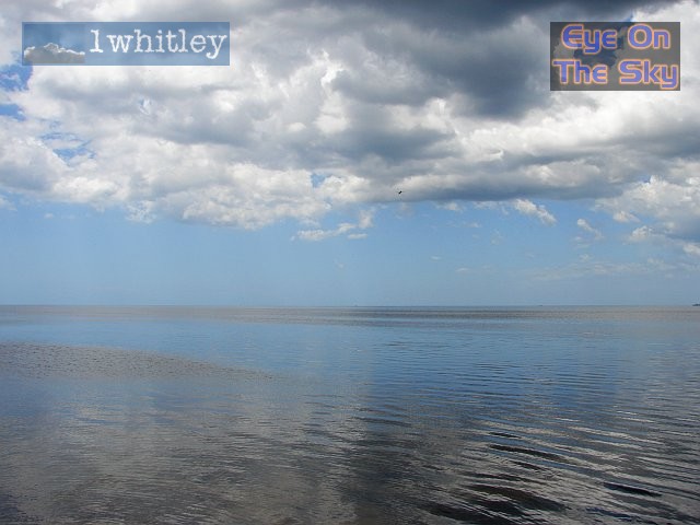
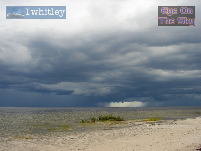
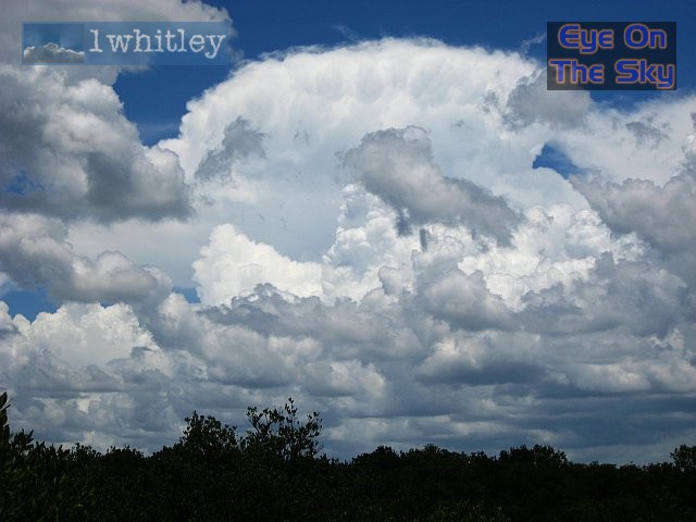 Viewing to the east, and inland, thunderstorms were developing over the interior of Florida, on the nose of another bout of tropical moisture. . |
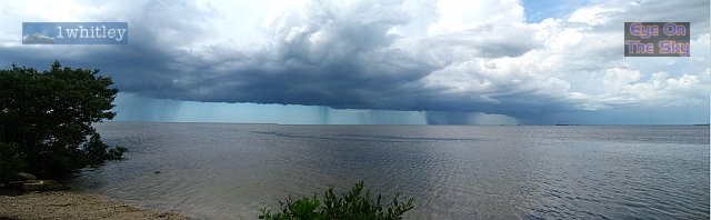
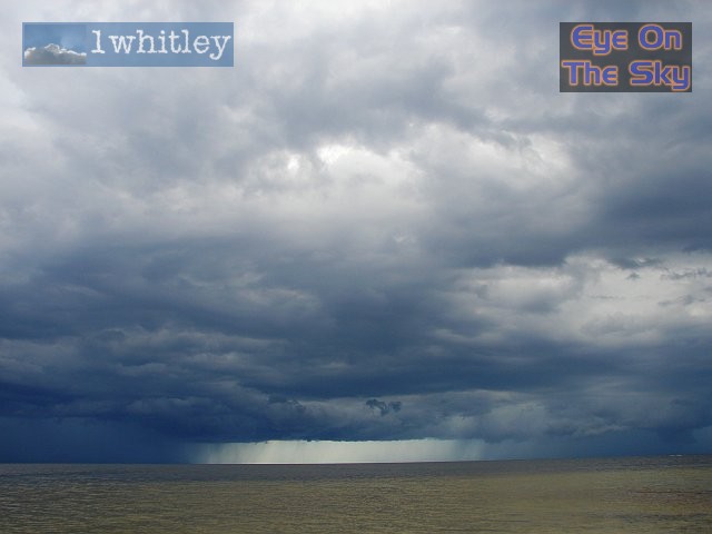
 These thunderstorms threw out an impressive gust-front, which soon became a marked outflow boundary.This photographs is taken looking northwards, with the outflow boundary moving right to left (east to west). It wasn't long before this outflow boundary met the west-coast sea-breeze, and growth suddenly accelerated. . |
 Our view north-westwards, as the developing squall-line moved overhead, before heading out further into the Gulf. . |
|
|
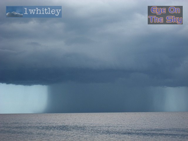
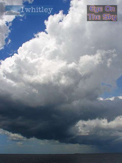
 Boats were lucky to pass beneath the updrafts, before wet microbursts slammed down onto the sea surface behind them. . |
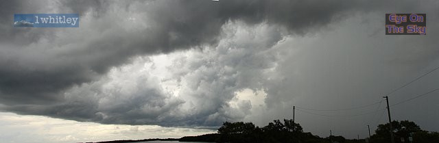
 Another view, looking north-westwards, as the squall-line continued to develop as it moved out to sea. . |
|
|
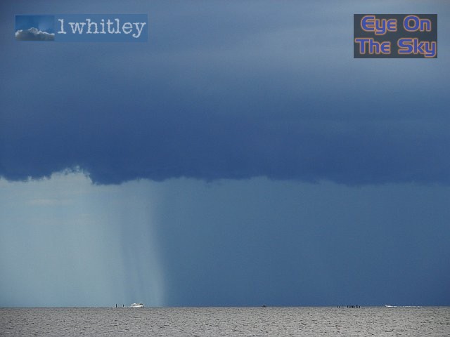
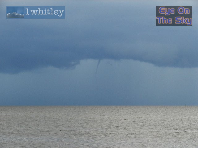
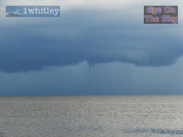
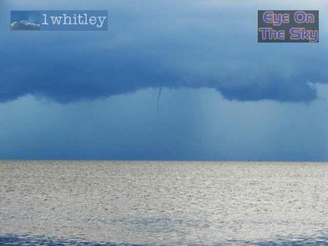 Funnel cloud! In fact, if you look closely, this could well have been a waterspout already, as the vortex can be seen almost making contact with the sea. . |
 The funnel lasted for several minutes, constantly changing shape. . |
 Unfortunately, the spout's touch-down was hidden from view by a combination of rain and sea-spray, just above the horizon here. . |
 We managed to video the waterspout too in timelapse, and look forward to getting this into our blog when we return to the UK. . |
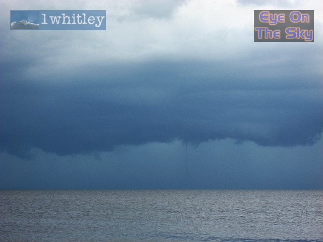
 As the watherspout began to dissipate, scud cloud could be seen rotating around it. |
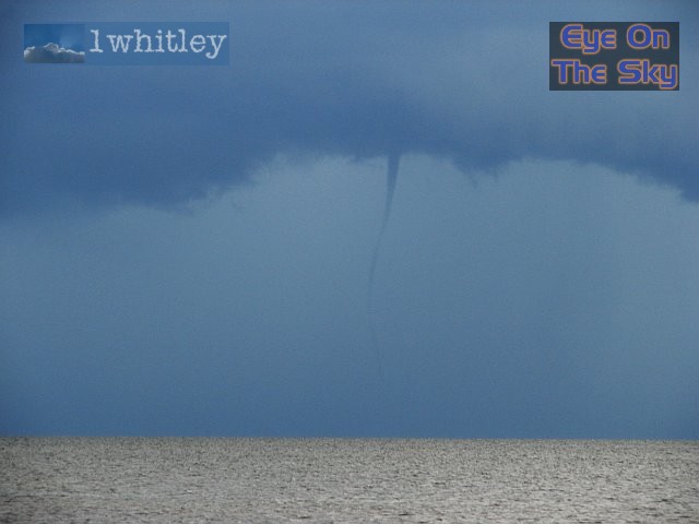
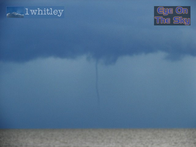 A little blurred, but the spout vortex is clearly seen getting close to the water's surface. |
 Once the spout disappeared, we turned our attention to the whole squall line, which was moving further away from us. Believe it or not, this was the small gap in the thunderstorm activity which kept us dry, as the convergence line moved overhead earlier. |
 Another view of the 'miracle gap', which was slowly becoming squeezed from each side. |
 Not much left of the gap now, as it continued Gulfwards. |
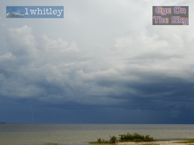 A faint CW lightning strike, captured on camera. Lightning was flashing every few seconds, but despite hard work, this was the only bolt we had the reactions to capture :( . |
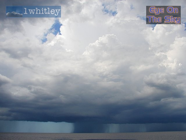
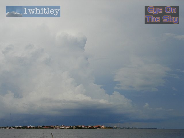 Behind the main squall line, more thunderstorm cells began to develop. This one was over downtown St Petersburg, and was developing beneath the anvils of the earlier squall line. . |
 This updraft appeared to be corkscrewing updwards, as its developing anvil merged with the anvil debris already left behind from earlier storms. |
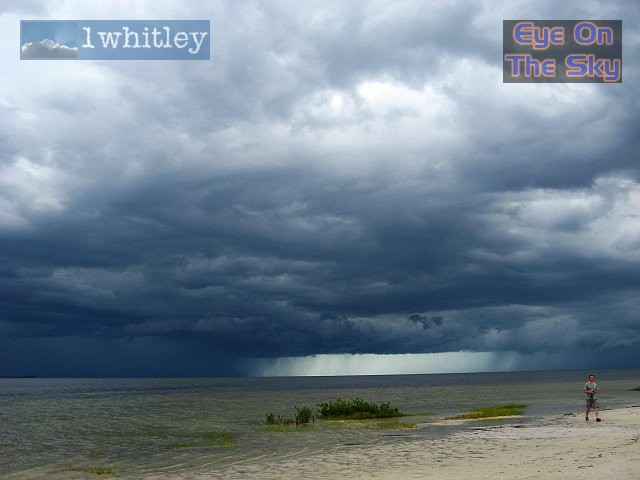
 As another storm moved towards us, it threw out another gust-front outflow boundary. This lovely horse-shoe outflow moved out into the Gulf, opening the doors for torrential rain in our location. |
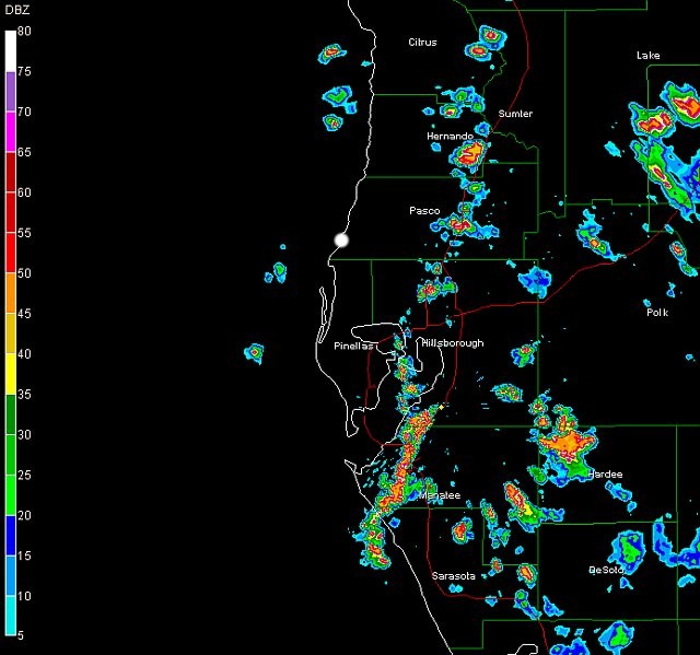 The squall line erupts over Manatee county, but remains broken further north at this time. The white dot shows out location during the early afternoon. Radar from GRLevel3 . |
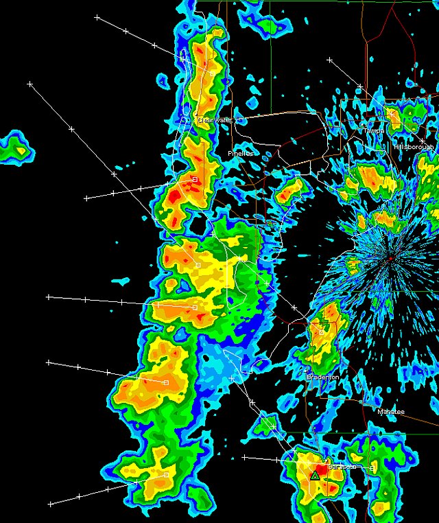 This is the squall line as it moved out to sea. Our location was right at the top of this image, with our 'miracle gap' clear to see. Radar from GRLevel3 . |
| Day 11 :: Home :: Day 13 |