|
|
| Day
3 3rd July 2006 |
|
3rd
July 2006: Day 3 Severe
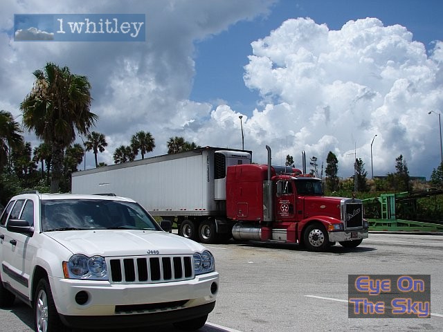
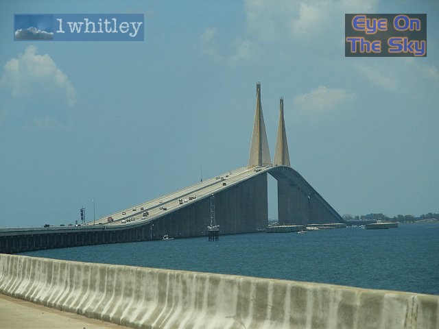
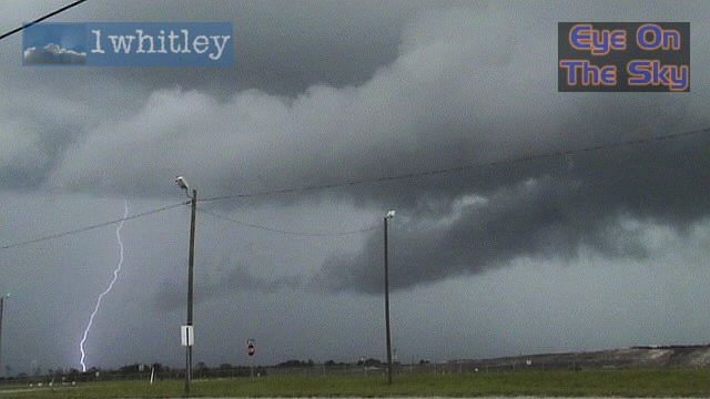
Thunderstorm Hits Tampa! The mission for the day was to head to the north Tampa/St. Petersburg area, to catch afternoon thunderstorms in that region. Drier air was filtering in from the north, but deep moisture remained across this area. A light easterly wind persisted at the surface, so we were expecting another sea-breeze convergence line to develop during the afternoon. We headed northwards by midday, crossing the spectacular Sunshine Skyway, which links the Bradenton area with St. Petersburg. Along side the Skyway was a small pier-road, which gave spectacular views across the bay. We parked up here in the blistering sunshine for a good couple of hours, watching an impressive thunderstorm developing over west Bradenton. This early thunderstorm was the result of rapid heating of the land, creating a very sharp thermal gradient on the coastal strip. Whilst we wanted to stay longer, in case this storm dropped a 'spout', we carried on northwards to our main destination. En route, we took in the sights of the west coastal strip of St Petersburg, with its hotels, beaches and cafes. By this time, the coastal strip was still in sunshine, but inland, huge thunderstorms were already filling the sky, as the sea-breeze convergence zone commenced. One particular storm began to look impressive at 4pm, so we decided to head inland to view it. As we were already heading towards the storm, which was situated north-east of St Petersburg over north-west Tampa, our NOAA weather radio crackled into life with a 'Severe Thunderstorm Warning'. The storm over North Tampa had been identified as severe, with damaging winds, large hail and dangerous lightning. Police in east Tampa had already confirmed that power lines had been brought down. Here is the warning as taken from the National Weather Service: BULLETIN
- EAS ACTIVATION REQUESTED THE NATIONAL WEATHER SERVICE IN RUSKIN HAS ISSUED A *
SEVERE THUNDERSTORM WARNING FOR... * UNTIL 500 PM EDT * AT 420 PM EDT...NATIONAL WEATHER SERVICE DOPPLER RADAR INDICATED A SEVERE THUNDERSTORM WITH DAMAGING WINDS...5 MILES NORTH OF TAMPA... MOVING SOUTH AT 25 MPH. *
THE SEVERE THUNDERSTORM WILL AFFECT... MOVE INSIDE A STURDY BUILDING. DAMAGING WIND...LARGE HAIL... TORRENTIAL RAIN...AND DEADLY LIGHTNING ARE EXPECTED. STAY INSIDE AWAY FROM WINDOWS UNTIL THE STORM HAS PASSED. WIND GUSTS TO 60 MPH WILL CAUSE SOME STRUCTURAL DAMAGE...MAINLY TO TREES AND POWER LINES. POORLY ANCHORED ROOFS...MOBILE HOMES...AND SHEDS ARE ALSO AT RISK. REPORT
SEVERE WEATHER OR DAMAGE TO THE NEAREST LAW ENFORCEMENT AGENCY The chase was on, and we wanted to see what this monster had to offer. However, we were trapped on an easterly freeway, heading right into the storm outflow. The storm's base was violently rotating, and accessory clouds were seemingly scraping along the ground beneath the storm. Frequent and powerful cloud-to-ground lightning was just a few miles away, so we took the decision to stop at the side of the main road to view. After a while, the storm quickly burned out, so we decided to make the journey home. All the time, the sky to our east was boiling with regenerating thunderstorms - so much so, that as we arrived home in Bradenton, we did a U-turn and headed east into the storms' paths. Here, we witnessed more lightning, gusty winds and heavy rain. As a new cell started to fire to our west, back in the direction from which we'd started, rotation could be seen in the updraft base. Before long, this rotation pulled in tight, and for a few short minutes, a funnel cloud attempted formation. However, it fell apart quickly after. We
arrived home around 8pm, and decided to have a swim in the pool. As
we did so, thunderstorms slowly moved in from the east, and moderate
rain began falling. Thankfully, the pool is covered by a metal cage
and netting, so we felt safe enough to keep on swimming, as the lightning
flew across the sky above. Total mileage: 164 |
| 6 |
|
|
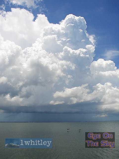
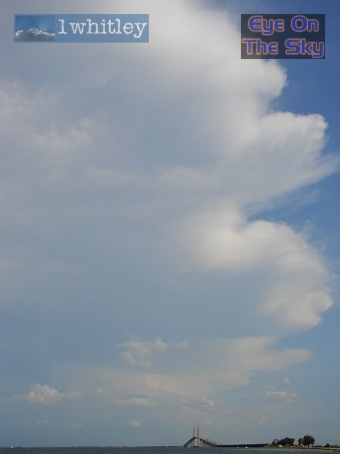
 Looking southwards towards the developing thunderstorm, across the waters of Tampa Bay. . |
 A pair of pelicans glide past, as the thunderstorm continued to grow. . |
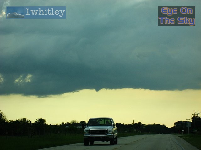
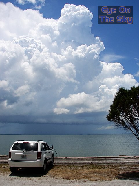 By this time, the thunderstorm had developed a gust front, which slowly moved towards us beneath the storm's boiling cloud structure. . |
|
|
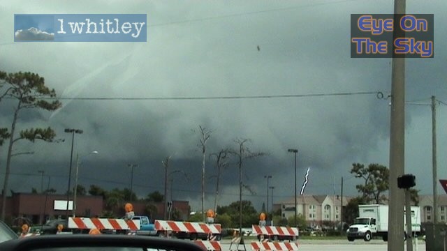 A video capture at 4:15pm. This was the base of the thunderstorm which had just been confirmed as 'severe'. This whole lowering below the main storm was rotating cyclonically, just a few hundred feet above the ground. CGs rained down constantly. . |
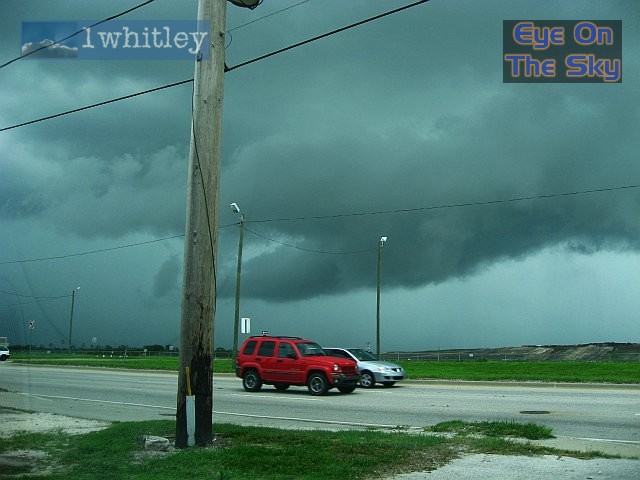 Another view of the storm base, just before the whole area was engulfed by heavy rain. . |
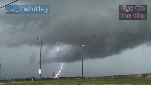 More powerful CGs, just a mile or so away. The tail cloud seen here was feeding into the parent storm at an alarming pace! . |
|
|
 The left-over anvil from the severe thunderstorm, as we returned southwards across the Sunshine Skyway. . |
 As a new cell developed towards ths coast, this small but perfectly formed funnel cloud tried to develop, complete with nice scud-cloud rotation around it. . |
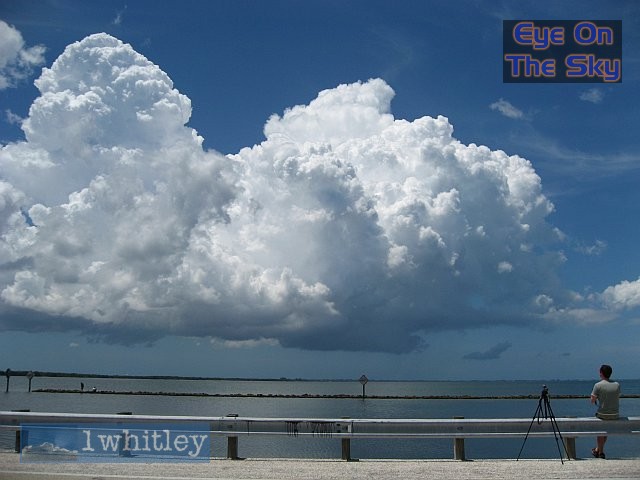
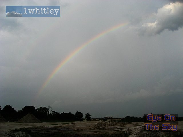 A nice scene to round off the trip :) . |