|
|
| Day 1 :: Home :: Day 3 |
|
29 June 2008 |
|
29/06 Day
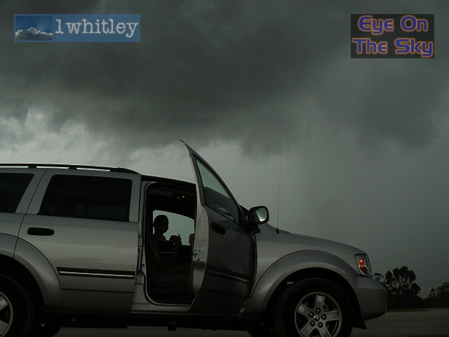
2 Testing the boundaries Our first full day in the Sunshine State started rather cool, after the previous evening's storms knocked temperatures on the head. Conditions were very hazy with lots of high cirrus cloud. After a morning swim and breakfast, we kicked off the day with a trip to Lake Manatee State Park, just a dozen or so miles east of our villa in Bradenton. The park is typical of Florida's natural wilderness, with moss hanging from the trees and lots of colourful wildlife. The wildlife took a liking to Bren in particular, who was munched on by red ants, black ants, a wasp and some hideous black fly. During the couple of hours we spent in the park, the west coast sea breeze fired up small popcorn storms just to our west. Numerous rumbles of thunder were heard and the sky gradually became filled with towering cumulus. At around 3pm, we decided to leave behind the small storms and head south-east into the interior parts of the Peninsula. Large thunderstorms on the Atlantic coast were sending huge outflow boundaries westwards in our direction, whilst the west coast sea breeze was continuing to move slowly inland. It looked like a collision would occur in our target area, and thus the thunderstorm potential was high. We drove south-eastwards through Manatee County, and onwards through Hardee County into DeSoto County, where we settled just east of Arcadia. Here, strong thunderstorms were developing, and we parked up to the west of a particularly good storm which was producing frequent lightning. The storm threw a gust front at us which, on arrival, pelted the car with sand and debris with wind speeds of around 30-40mph. Some heavy rain was also witnessed, although the storm quickly began to fall apart. To our north, over northern Hardee and Polk counties, skies were still clear with strong sunshine, and it looked as if two or more outflow/sea-breeze boundaries could collide over the area. Therefore, we headed back north again, stopping off near Zolfo Springs to watch another short-lived but intense pulse thunderstorm. We were keeping just a couple of miles behind a north-west moving outflow boundary. This generated storm after storm as it moved north, but we were managing to keep ourselves tucked into the clear gap immediately behind the boundary and ahead of the new storms which were firing behind us. We eventually arrived in the area north of Bartow, Polk County. The area was very urban and thus the potential for parking up with good views were very limited. It was now mid-evening and light was fading, so despite being surrounded by active (and briefly severe) thunderstorms, we decided to head for home. We kept almost directly underneath the outflow boundary as it moved westwards towards the Gulf Coast, eventually overtaking it and arriving home in time to see it pass over our villa, bringing gusty winds but no rain. A good start to the chase trip with short-lived but quite intense thunderstorms. The theory behind outflow boundaries was working well. Total mileage: 230 |
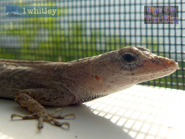 Just one of the many residents who join us for breakfast every morning. . |
 High noon was approaching and temperatures were firmly in the mid 90s. . |
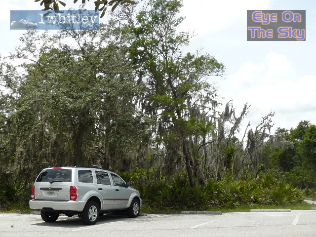 Parked up in Lake Manatee State Park. Many of the trees are covered in various mosses. . |
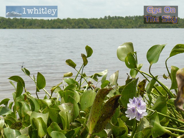 The view across Lake Manatee. . |
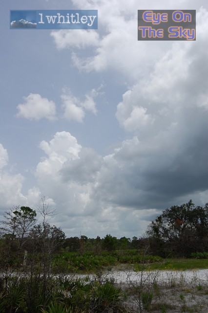 By early afternoon, the west coast sea breeze was generating small pulse thunderstorms. . |
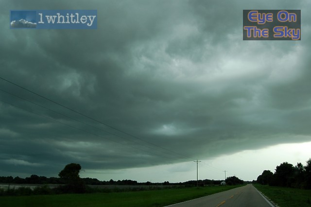
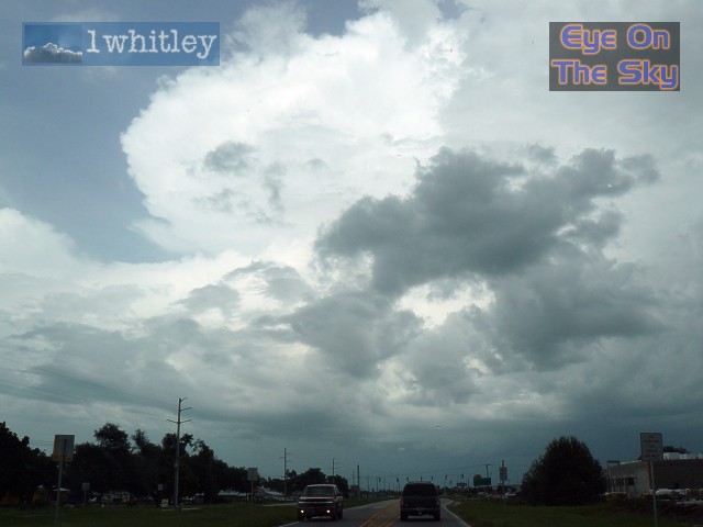 A few miles east of Arcadia, something monstrous loomed in the distance.... so we drove into it! . |
 And a short time later, we approached the base of this increasingly strong thunderstorm. . |
|
|
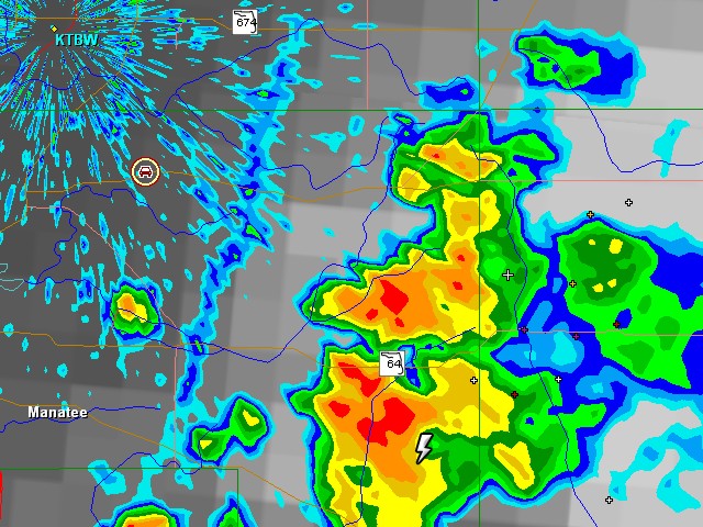
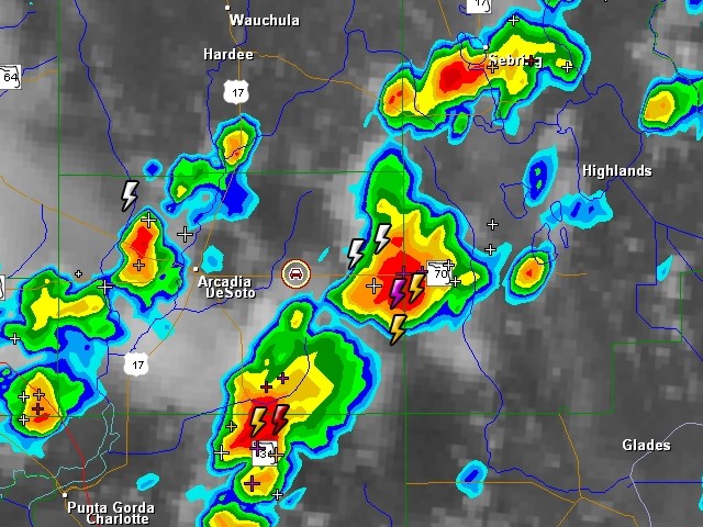 A radar grab of the developing storm east of Arcadia. Our location is shown by the small car GPS symbol. Radar from GRLevel3 . |
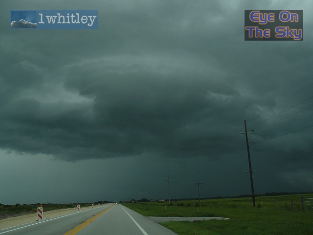
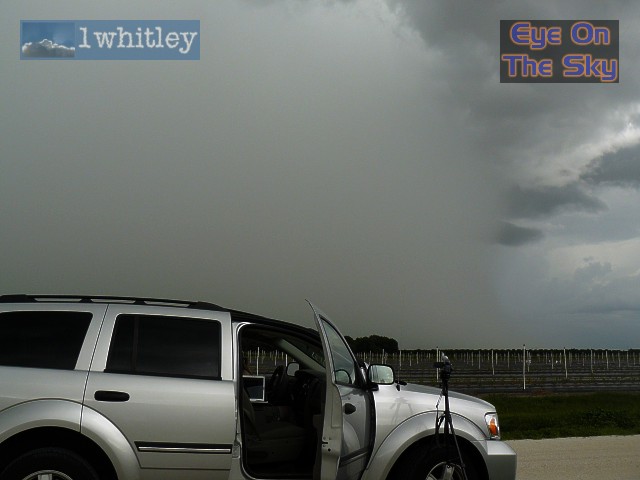
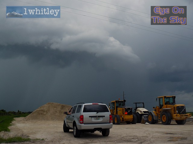 The storm's gust front began racing towards our construction site viewing spot. With the gust front came strong winds, blowing dust and rain. . |
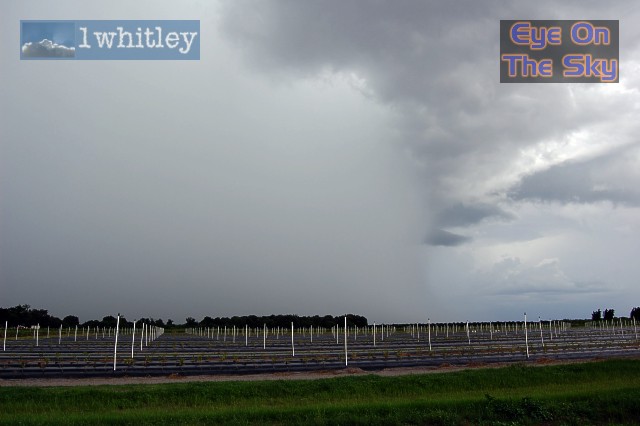
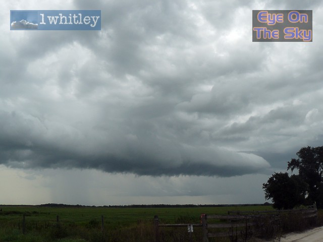 Once the gust front passed overhead, it narrowed to form a roll cloud which would go on to become a major outflow boundary. . |
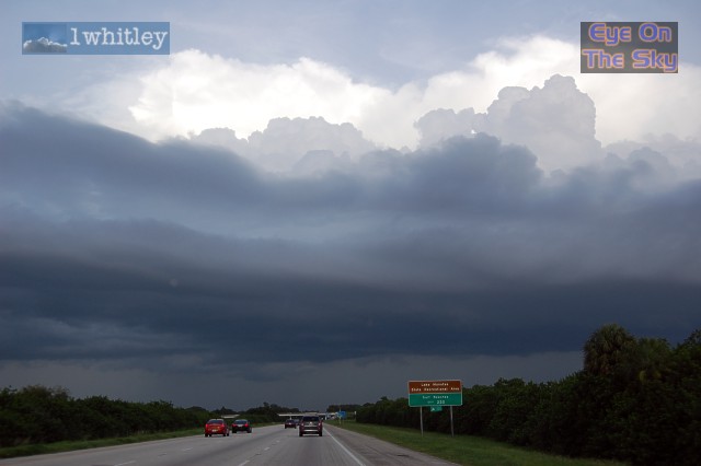
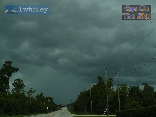 East of Zolfo Springs, the next storm was looming large over the Florida countryside. . |
 As we parked up to watch the storm pass just to our east, a huge wet microburst collapsed to the ground less than a mile away. . |
 Another view of the major downdraft. . |
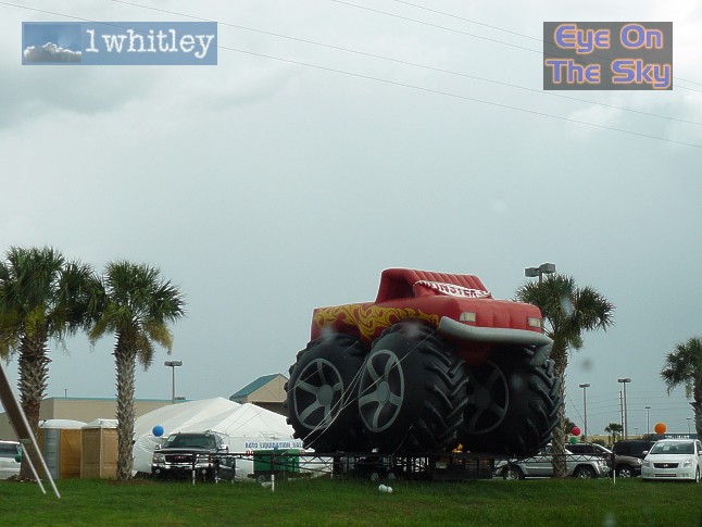 The storms were producing strong winds. This monster truck was trying to take off! . |
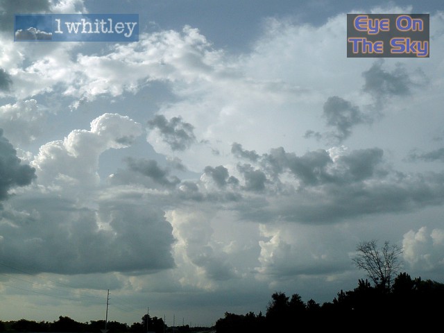 Heading further north, towering thunderstorms were becoming severe between Tampa and Orlando. . |
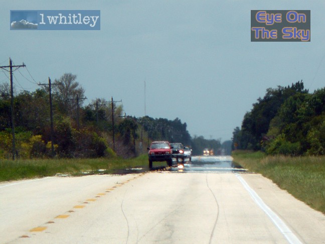
 On the home stretch, we followed the major outflow boundary back to the west coast. . |
 We actually overtook the boundary, and as we looked back eastwards, this boundary (dark cloud in foreground) was generating storm after storm (background). . |
 A radar grab as we were heading back westwards, almost surfing the outflow boundary that was chasing us back to the coast. Storms were firing like clockwork behind and to the east of the boundary. Radar from GRLevel3 . |
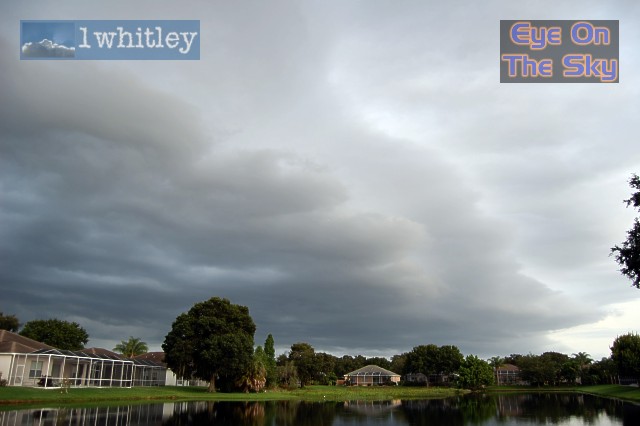 And back at base in Bradenton, all that was left of the boundary as it moved from left to right across our view was this layered shelf of cloud. Winds increased markedly as this went through. . |
| Day 1 :: Home :: Day 3 |