|
|
| Day 2 :: Home :: Day 4 |
|
30 June 2008 |
|
30/06
Day 3 Space Coast Severes A cold front was moving across the south-eastern States, including northern Florida, unusually far southwards for the time of year. As this cold front encountered the deep, tropical moisture across the northern peninsula, there was a real threat of severe weather. So, we decided to make the drive to northern parts of Florida through the day to see whether the severe threat was justified. We travelled northwards during the late morning, stopping in Ocala in Marion County for lunch. A line of thunderstorms was already developing ahead of the cold front, and these pulse storms rumbled outside as we tucked into pizza. Once lunch was over, we continued to drive a little further north to encounter the cold front on the Alachula County border. This brought an abrupt change to very cloudy conditions with torrential rain and strong winds, albeit with very little lightning. It appeared that the severe portions of the front were already clearing eastwards into the Atlantic. A pre-frontal squall line was developing nicely to our south, some of the cells with severe warnings tagged to them. After weighing up our options, we decided to head south-eastwards towards the coast at Melbourne. Our theory was that the eastward-moving squall would encounter the east coast sea breeze later in the day, and skies were still sunny in the Melbourne area, adding extra heat to the equation. So, we headed eastwards to I-95, then southwards along the Space Coast. We were forced to punch through the squall line north of Titusville. The heaviest rain we've ever seen effectively brought the interstate to a standstill, with most people opting to pull onto the hard shoulder and wait out the storm. Small hail and very gusty winds were witnessed, as well as frequent cloud-to-ground lightning. We exited the southern side of the squall, and on looking back were greeted with a superb barrage of thunder clouds, together with a stunning shelf cloud. The next few hours were spent driving stop-start southwards along the coast. As the line of storms were orientated south-west to north-east, they were hitting the coast at an angle, which was spreading southwards along the coast like a closing zip. Each time we stopped to let the storm approach, we were blasted by strong outflow winds carrying sand, dust and other painful particules. We also witnessed numerous branches torn from trees, bins and shop fronts blown over, and a significant drop in temperature. At Cape Canaveral, wind gusts exceeded 60mph, blowing sand and dust into the car even though the windows were shut! We finished up around Melbourne, allowing the line of storms to pass over us. Lightning was still frequent enough to allow us some night-time photography, before we checked into a hotel on the western side of Melbourne. More storms are likely tomorrow in this area, so we're well-placed. Total mileage: 364 |
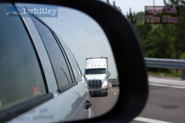 One of the many things in the US that are bigger and better than the UK version... a daunting sight in the rear-view mirror, especially when already in the fast lane doing 80mph! . |
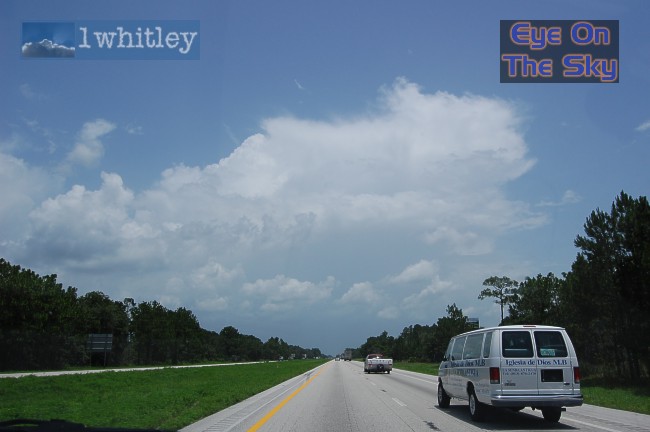 Heading up the I-75 towards Ocala, and the first cells of the day were firing nicely. . |
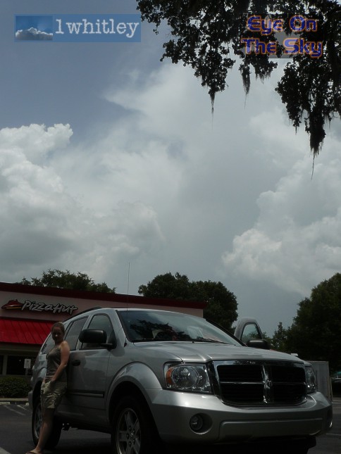 Post-pizza, Laura tries not to look guilty for visiting yet another fast-food joint. In the background, a storm rumbles away. . |
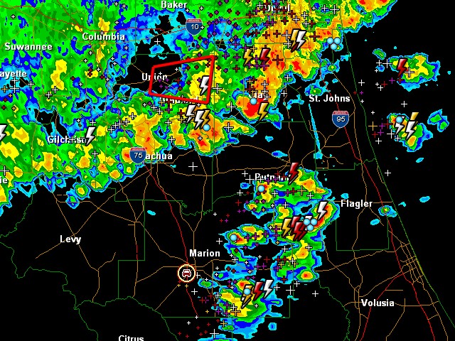 Radar grab showing our location between pre-frontal thunderstorms and the cold front squall to our north. Radar from GRLevel3. . |
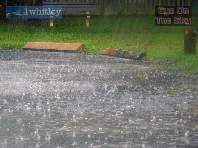 Now under the cold front squall-line, torrential rain batters down and cloud-to-ground lightning flashes close by. . |
 What a drop in temperature! It was in the low 90s before the squall arrived. . |
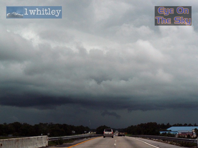
 The leading edge of the cold front squall. . |
 Now on the I-95 heading south, ready to punch through a pre-frontal line of thunderstorms to escape out into the sunny side. . |
|
|
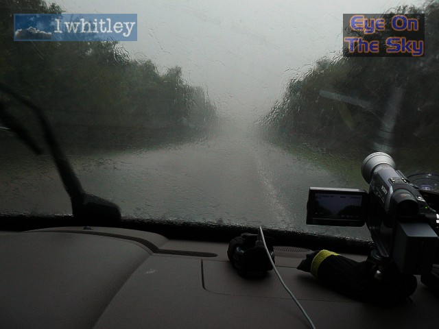 On the I-95, torrential rain seriously impeding vision! . |
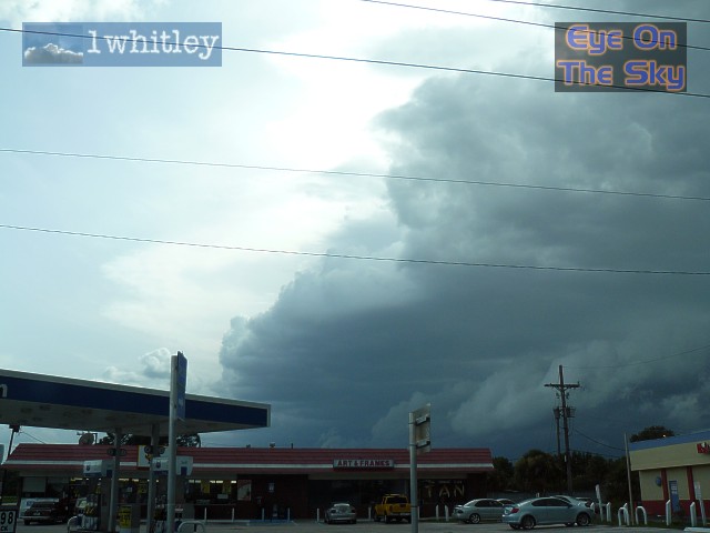 Once through the line, we had a fantastic view of the edge of the thunderstorms, and the associated gust front. . |
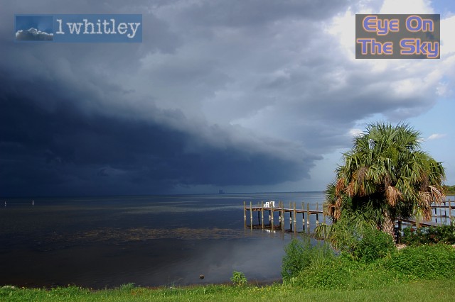 We managed to stop by a waterside bar, which had amazing views towards Kennedy Space Center and the huge building in which NASA's orbiter is attached to its fuel tanks prior to making its way out to the launch pad. When we first arrived, temperatures were in the mid-90s and the breeze was light. Within minutes, the gust front arrived, the bar had to close its shutters, and the temperture plummeted again! . |
 Moving on to our next viewpoint, near Titusville. . |
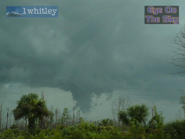
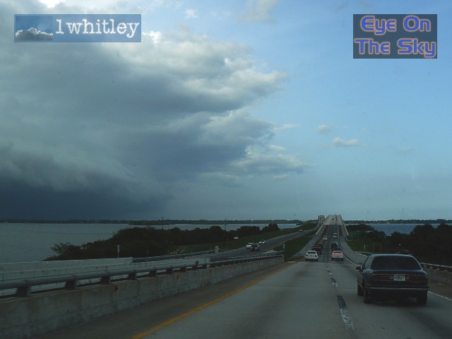
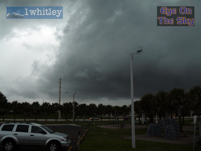
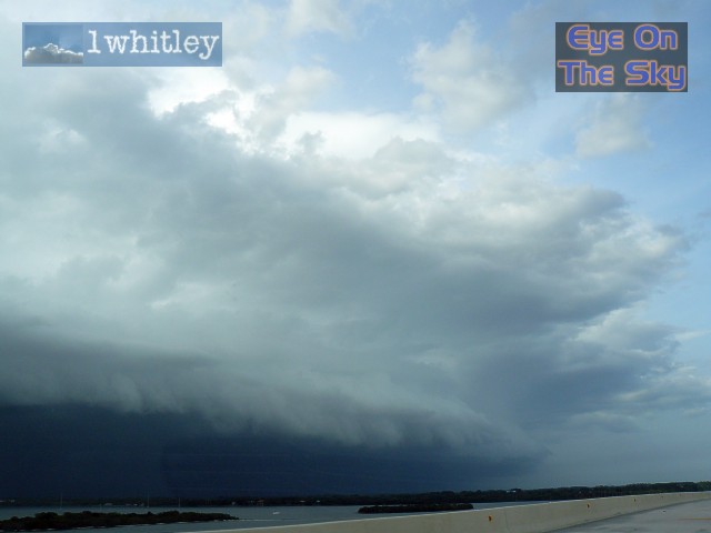 From the bridge we had a spectacular view of the roaring shelf cloud. . |
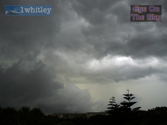
 The storm munches on... . |
 Having reached the coast, we found a lovely Atlantic-side viewpoint. However, the sand was not as appeciated once the gust front arrived! . |
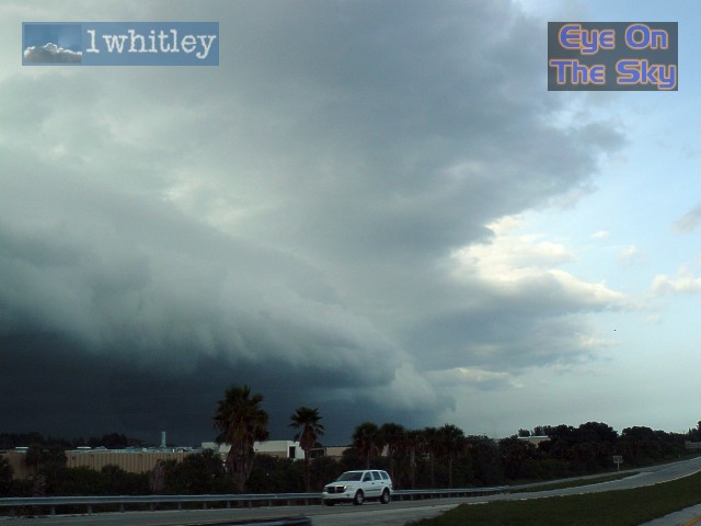
 The form of the squall line was beginning to look less spectacular, but the gustiness and lightning was just as prolific. . |
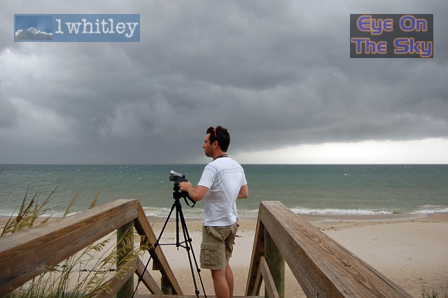
 At this point, the lightning was rather close, so Laura wisely remained in the car whilst Bren bravely assembled the camcorder on its tripod on a nearby boardwalk. . |
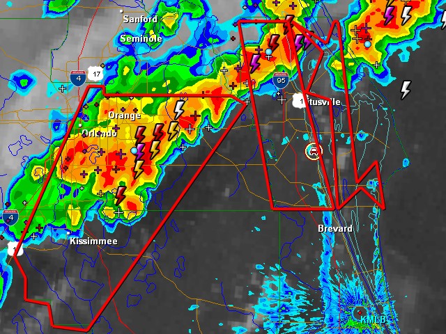 Radar grab showing our location, south of Titusville, within the Severe Thunderstorm Warning. The line of storms was moving east towards the coast. The west coast sea breeze boundary can be seen in the bottom-right of the image, stretching southwards through Brevard County towards Melbourne. Radar from GRLevel3. . |
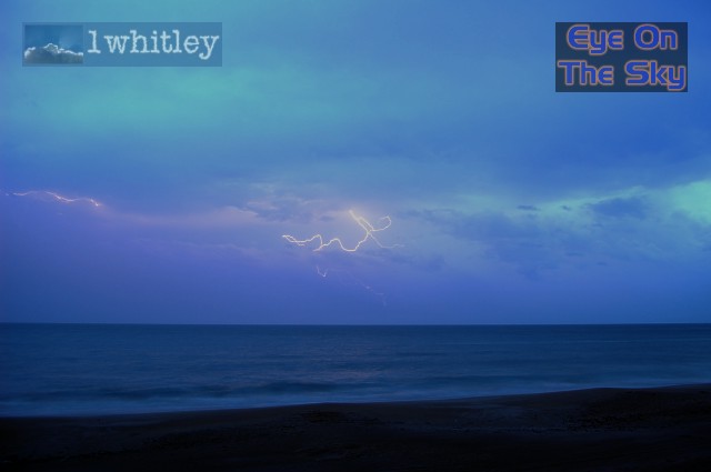 As darkness fell, Laura finally got a chance to test her Nikon D40 on the lightning. With a little success! . |
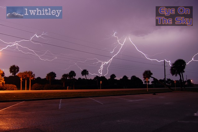 Wires and pylons aside, Laura was rather pleased with the results! . |
| Day 2 :: Home :: Day 4 |